
Spring Gap-Stanislaus Hydroelectric Project
Federal Energy Regulatory Commission (FERC) Project No. 2130
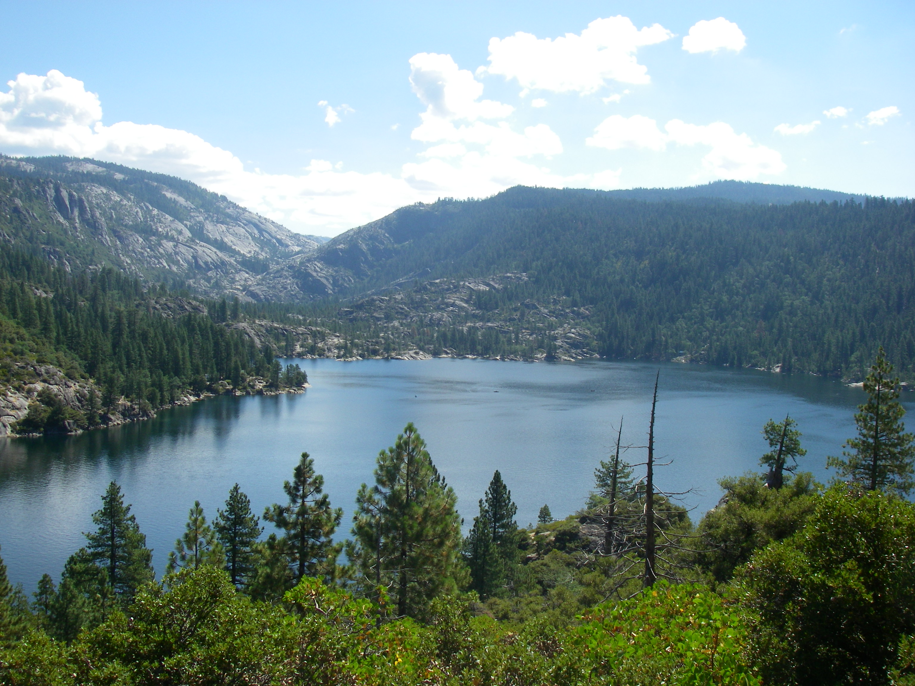 |
| Pinecrest Reservoir Image provided by State Water Board staff. |
County: Tuolumne
License Expiration Date: March 31, 2047
Water Quality Certification Status: Final issued June 16, 2009
Waterbody: Middle and South Fork Stanislaus River
FERC Licensing Process: Traditional Licensing Process
The Spring Gap–Stanislaus Hydroelectric Project (Project) is located on the Middle and South Forks of the Stanislaus River in the Sierra Nevada Mountain Range. Project features range in elevation from about 7,300 feet at Relief Reservoir to 1,000 feet at Stanislaus Powerhouse. Access to the upper regions of the Project is via State Highway 108 (Sonora Pass) and a series of U.S. Forest Service maintained dirt roads. Access to the lower regions is via Highway 49 and Camp Nine Road.
Under PG&E’s new license, the Project is operated similar to historical operations, with the major differences being modified minimum streamflow regimes, modified reservoir operations, and new environmental measures to address best management practices and environmental laws that did not exist at the time of the original FERC license in the 1950’s.
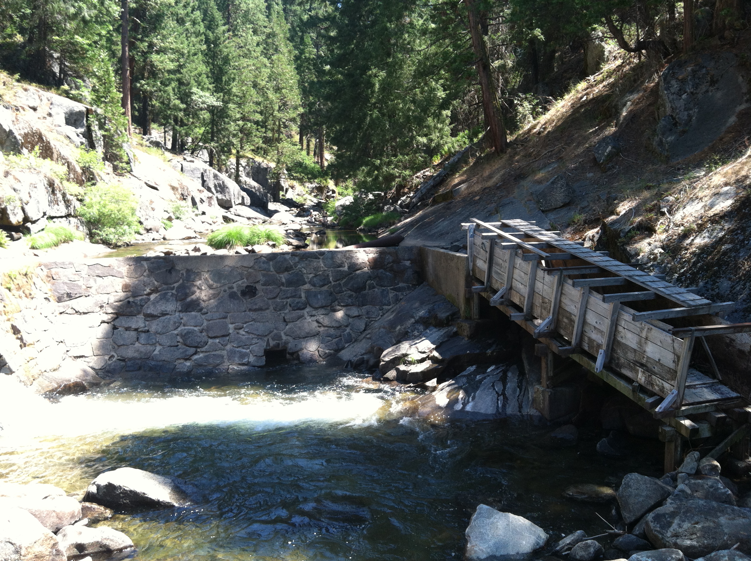 |
| Philadelphia Diversion Image provided by State Water Board staff. |
There are four main developments in the Project, Relief Dam, Strawberry Dam (Pinecrest Lake), the Spring Gap Powerhouse, and the Stanislaus Powerhouse. Between Relief Dam and the other Project developments is the Beardsley/Donnells Project (FERC No. 2005) owned by the Tri‑Dam Project Authority. As part of the new license for the Project, the Stanislaus Afterbay Dam has been removed and PG&E will operate a fish screen at the intake to the Stanislaus Power Tunnel.
Relief Reach-Kennedy Meadows Riparian Restoration and Streambank Stabilization Project (Kennedy Meadows)
PG&E is required by the Federal Energy Regulatory Commission license for the Project to evaluate riparian and streambank conditions in upper Kennedy Meadows (Project Reach) on the Middle Fork Stanislaus River below Relief Dam and to develop and implement vegetation restoration and streambank stabilization measures. These requirements derive from Article 401 of the License, which implements the United State Department of Agriculture–Forest Service (Forest Service) Condition 4(e) and Condition 9 of the State Water Board 401 Water Quality Certification.
The Project proposes streambank stabilization and enhancement of riparian and aquatic habitats within the Project Reach. The streambank stabilization and riparian restoration measures are proposed along a 3,000–linear foot reach along the Middle Fork Stanislaus River. The proposed measures include a combination of various bioengineering techniques, including streambank grading, wood and rock placement, and native vegetation planting. Toe rock additions and root wad series are proposed in areas with more recent and severe active streambank erosion, and where flow velocities are higher during high flows compared to the other treatment areas. Split rail fencing will also be installed in two segments at the downstream end of the Project Reach to protect the restored vegetation and banks. A river access area utilized by recreationists and cattle will remain open to focus access to the river.
Pinecrest Reservoir Minimum Lake Level
PG&E requested a modification to Condition No. 4 of its water quality certification (certification) for the Project, issued by the State Water Board under Order WR 2009–0039. Currently, Condition No. 4 requires that after spill ends each year, PG&E maintain a pool elevation above 5,608 feet in the Pinecrest Reservoir prior to and including Labor Day. In addition, PG&E is required to prepare a drawdown curve for Pinecrest Reservoir by April 15 of each year, which estimates the lake level at Labor Day for that year. After Labor Day, Pinecrest Reservoir is allowed to release water from Strawberry Dam down to a minimum storage of 500 acre–feet. Pinecrest Lake is drawn down by an additional 71 to 94 feet after Labor Day to generate hydropower, provide water supply to downstream users, and satisfy minimum instream flows requirements.
As part of the certification, PG&E was required to complete a Pinecrest Reservoir lake level study to identify the impacts to recreation from lake levels below 5,608 feet before Labor Day. PG&E completed this study in April 2011, and subsequently submitted the above–referenced request to the State Water Board to revise Condition No. 4. The lake level study identified impacts to certain recreational uses as a result of lower lake levels before Labor Day, and PG&E put forth a mitigation plan to address the impacts identified in the lake level study when it made the modification request.
State Water Board staff held a public workshop in October 2012 to gather comments on PG&E’s modification request. The State Water Board is evaluating PG&E’s modification request and is currently preparing an environmental document to comply with the California Environmental Quality Act (CEQA). The CEQA document will disclose the impacts of the requested modification to Project operations.
PG&E’s website for Pinecrest Lake contains more information about the management of the lake for recreation and power generation.
Related Documents
Spring Gap-Stanislaus (FERC Project 2130) Licensing
- Final Spring Gap-Stanislaus Hydroelectric Project Water Quality Certification Amendment Approval Letter – August 6, 2020
- 2015 Revised 401 Certification (Variance)
- 2014 Revised 401 Certification (Variance)
- Order WR 2009-0039 – June 16, 2009
- Petitions for Reconsideration
- State Water Resources Control Board Notice of Petition, Final – May 18, 2009
- State Water Resources Control Board Notice of Petitions – May 7, 2009
- Tuolumne Utilities District Supplemental Petition for Reconsideration – May 4, 2009
- Pacific Gas and Electric Company Petition for Reconsideration – May 4, 2009
- Tuolumne Utilities District Petition for Reconsideration – October 15, 2008
- Pacific Gas and Electric Company Original Petition for Reconsideration - September 15, 2008
- Notice of Intent to Adopt a Mitigated Negative Declaration and Issue Water Quality Certification for the Spring Gap-Stanislaus Project, FERC No. 2130 – August 1, 2007
- 401 Certification – September 15, 2006
Kennedy Meadows Project Information
- Water Quality Certification for the Relief Reach–Kennedy Meadows Riparian Restoration and Streambank Stabilization Project – September 6, 2017
- Notice of Determination – September 1, 2017
- Negative Declaration – September 1, 2017
- Notice of Intent to Adopt a Negative Declaration – June 7, 2017
- Initial Study/Negative Declaration and Appendices – June 7, 2017
- Comments Received:
- Notice of Completion and Attachment A – June 7, 2017
- Notice of Application – February 23, 2017
Modification Request for Pinecrest Reservoir Lake Levels
- Final Spring Gap–Stanislaus Hydroelectric Project Water Quality Certification Amendment Approval Letter – August 6, 2020
- Notice of Determination – August 6, 2020
- Notice of Public Comment Period for Draft Water Quality Certification Amendment Related to Pinecrest Lake Levels – January 28, 2020
- Notice of Intent to Adopt a Mitigated Negative Declaration – March 16, 2015
- Comment Letters – Deadline to receive comments was 12:00 pm April 15, 2015
- Mitigated Negative Declaration for Pinecrest Lake Level Modification Project – March 16, 2015
- Notice of Completion – March 16, 2015
- Notice of Staff Workshop and Opportunity to Comment on Water Quality Certification Conditions – September 20, 2012
- Staff Workshop Agenda – October 4, 2012
- PowerPoint Presentation: Color (full screen) or Black & White (handout) – October 4, 2012
- Comment Letters on Water Quality Certification Conditions – Deadline to receive comments was 12:00 pm October 18, 2012
- Fact Sheet – State Water Board Process on PG&E Request for Change to Minimum Pinecrest Reservoir Level – September 20, 2012
- PG&E's Request for Pinecrest Lake Level Modification – December 16, 2011
- Interested Party Comments – Deadline to receive comments was October 24, 2011
- Final Pinecrest Reservoir Lake Level Report – April 2011
- Pinecrest Reservoir Lake Level Study Plan – June 2010
Other Post Certification Actions
- Approval of Variance Request to Minimum Instream Flows Below Relief Reservoir – January 24, 2024
- Compliance Concerns with Spring Gap-Stanislaus Hydroelectric Project Water Quality Certification Conditions – July 12, 2023
- Response to Notice of Gauging Weir S–83 Construction Delays – July 3, 2013
- Notice of Gauging Weir S–83 Construction Delays – June 24, 2013
- Stanislaus Power Tunnel Fish Screen Approval – May 28, 2013
- Sand Bar Dam Weir and Cableway Project – February 28, 2013
- Stanislaus Afterbay Dam Removal Project Approval – September 21, 2012
- Response to Request to Modify the Water Quality Certification for Relief Reservoir on the Spring Gap-Stanislaus Hydroelectric Project – April 27, 2012
Drought Information
- Response to Request for Supplemental and Recreational Flow Variances – April 27, 2015
- Supplemental Flow Variance Request - February 25, 2015
- Notice of Request for Supplemental Flow Variance - March 25, 2015
- Joint Comment from Conservation Groups - April 2, 2015
- Response to Request for Temporary Variance Request - July 10, 2014
- PG&E Letter Requesting Variance of Minimum Water Surface Elevation of Pinecrest Reservoir – July 10, 2014
- Response to request for Variance of Supplemental and Recreational Flows – May 1, 2014
- Notice of Exemption filed by State Water Board – May 1, 2014
- Notice of Exemption filed by Tri Dam Project – April 30, 2014
- PG&E and Tri-Dam Project Request for Variance of Supplemental and Recreational Flow Requirements – April 9, 2014
- Notice of Request for Variance of Supplemental and Recreational Flow Requirement – April 4, 2014
- Public Comments
- Response to Request for Relief Reservoir Instream Flows and Minimum Pool Variance – January 16, 2014
- Response to Request for Approval of Revised Relief Reservoir Drawdown Curve and Minimum Instream Flows – December 16, 2013
- Response to Request for Temporary Variance Request of Condition #4 of the Water Quality Certification for the Spring Gap-Stanislaus Hydroelectric Project – July 10, 2012
- Notice of Request for Variance to the Water Quality Certification for the Spring Gap-Stanislaus Hydroelectric Project
- Letters from PG&E and Tuolumne Utility District requesting variance – May 18-11, 2012
- Comment Letters on Notice of Request for Variance
- Del Oro Water Company – June 28, 2012
- California Fisheries and Water Unlimited – May 24, 2012
- Central Sierra Environmental Resource Center – June 1, 2012
- United States Department of Agriculture – June 5, 2012
- Tuolumne County Board of Supervisors – June 5, 2012
- Tuolumne County Farm Bureau – June 15, 2012
- Tuolumne County Chamber of Commerce – June 19, 2012
- Tuolumne County Business Council – June 19, 2012
- Tuolumne County Building Industry – June 19, 2012
- California Farm Bureau – June 25, 2012
