The Salton Sea Transboundary Watershed Staff Report
California Environmental Protection Agency
Regional Water Quality Control Board
Colorado River Basin Region
Staff Report: Water Quality Issues in the
Salton Sea Transboundary Watershed
September 2000
The Salton Sea Transboundary Watershed is a watershed cross-cut by boundaries – boundaries include those of tribes, nations, counties, water districts, joint-powers authorities, and local, state, and federal agencies. Once you have identified these boundaries, current ecological and political issues breach those boundaries: Essentially, the sole source of water to the watershed is the Colorado River, a waterbody once naturally hydrologically connected the to Salton Sea Basin, but today hydrologically connected through a vast system of water projects. The Salton Sea ecosystem is considered a critical link on the international Pacific Flyway. Freshwater inflow to the Sea is uncertain due to proposed water transfers and water conservation both in the U.S. and in Mexico. Solutions are further colored by the complex historical and political issues surrounding the use of Colorado River water.
The Salton Sea Transboundary Watershed is the Region’s Priority Watershed. The watershed is located in the Sonoran desert region in the southeastern corner of California, encompasses one-third of the Colorado River Basin Region (about 8,360 square miles), and contains five (out of a total of six) of the Region’s 303(d) Listed impaired surface waterbodies.
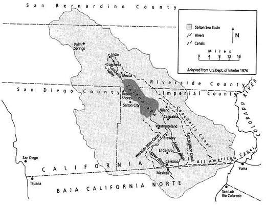
Most of the watershed is in Imperial County, but it also receives drainage from Coachella Valley in Riverside County and the Mexicali Valley in Mexico (via the New River). The watershed has been identified as a Category I (impaired) Watershed under the 1998 California Unified Watershed Assessment. Water imported from the Colorado River has created an irrigated agricultural ecosystem in the Salton Sea Transboundary Watershed; wildlife and aquatic species are dependent on habitat created and maintained through the discharge of agricultural return flows. Major waterbodies in the watershed include the Salton Sea, the Alamo River, the New River, the Imperial Valley Agricultural Drains, and the Coachella Valley Stormwater Channel. Other waterbodies of importance include San Felipe Creek and Salt Creek, which provide critical habitat for the endangered desert pupfish. Aquatic and wildlife habitat uses that developed incidental to the importation of water into the desert are designated as beneficial uses in the Region’s Water Quality Control Plan (Basin Plan).
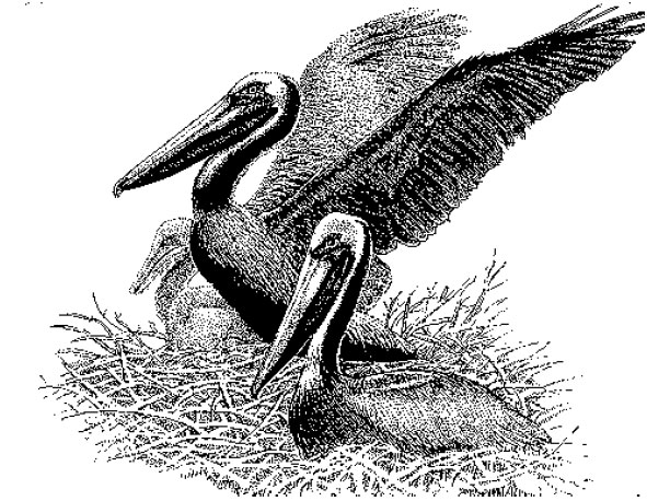
Great concern recently has been expressed about the fate of the Salton Sea ecosystem because of increasing salinity, contamination from agricultural and urban sources, disease outbreaks, and large die-offs of waterbirds. Particularly hard hit in the 1990s were the Eared Grebe (150,000 in 1992, unknown causes); American White Pelican
(9,000 in 1996, botulism); Brown Pelican (1,200 in 1996, botulism); and waterfowl, shorebirds, and waders (>11,000 in 1998, avian cholera). Concern is heightened because connections with other important ecosystems in western North America link the health of populations of many species of waterbirds to that of the Salton Sea. Additionally, because of the loss or degradation of other major wetland systems in the Pacific Flyway, including the nearby Río Colorado Delta region, birds have become increasingly dependent on the Salton Sea.
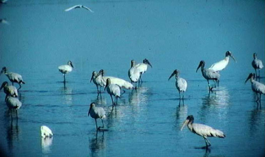
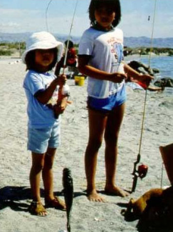
Prior and current data demonstrate that the Salton Sea supports large numbers and a great variety of avian species and is arguably one of the most important wetlands to birds in North America. The Salton Sea hosts hundreds of thousands, and at times low millions, of migratory, wintering, and breeding birds and is the destination for many post-breeding birds moving north from Mexico. Populations in the Salton Sea area of a number of species – Eared Grebe, American White Pelican, White-faced Ibis, Ruddy Duck, Mountain Plover, Black Tern, and Burrowing Owl – are of regional, continental, or worldwide importance. Colonial breeding species with significant populations at the Sea include the Double-crested Cormorant, Cattle Egret, Gull-billed Tern, Caspian Tern, and Black Skimmer. The Sea also supports notable populations of a number of additional taxa of concern for conservation, such as the Fulvous Whistling-Duck, Least Bittern, Wood Stork, Yuma Clapper Rail, Black Rail, and Snowy Plover. Although waterbirds are widely distributed in various habitats at the Salton Sea and Imperial Valley, studies in 1999 documented particularly large concentrations of waterbirds at both the north and south ends of the Sea. Isolated river deltas and islands were very important refuges for large flocks of roosting and colonial nesting birds.
Salton Sea
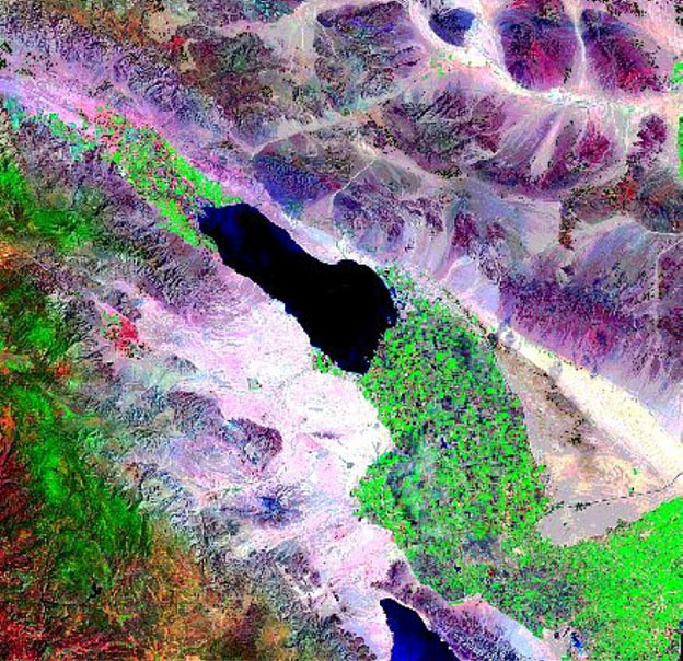
The Salton Sea is a closed basin, saline lake that is about 35 miles long and 9 to 15 miles wide with approximately 360 square miles of water surface area and 105 miles of shoreline. The surface of the Sea lies approximately 227 feet below mean sea level. The Salton Sea is a designated repository for agricultural return flows from the Imperial and Coachella Valleys. In 1924 and 1928, President Coolidge executed Public Water Reserve Order Numbers 90 and 114, respectively, for withdrawal of 123,360 acres of public land lying at an elevation of 220 feet below MSL, in and surrounding the Salton Sea. These lands were designated as a repository to receive and store agricultural, surface, and subsurface drainage waters. The State of California designated the Sea for this same purpose in 1968. The current inflow into the Salton Sea is about 1.3-million acre-feet per year, which is approximately equal to the rate of evaporation. Currently, the Sea is 25% saltier than the ocean (total dissolved solids concentration of 44,000 milligrams per liter), with salinity increasing at approximately 1% per year. Over 70% of the freshwater inflows to the Sea consist of agricultural drain water from Imperial Valley. Because the Sea has no outlet, salts concentrate in it and nutrients enhance the formation of eutrophic conditions. The Sea’s salinity problem cannot be directly addressed from a strictly regulatory standpoint; rather a coordinated solution involving an engineered solution aimed at stabilization and/or restoration of salinity levels must be developed. The Salton Sea can also be classified as a eutrophic lake - impaired by nutrients, which result in low dissolved oxygen, high ammonia levels, and foul odors. The Sonny Bono Salton Sea National Wildlife Refuge was established in 1930 to preserve wintering habitat for millions of waterfowl and other migratory birds. Today, the National Wildlife Refuge is a critical stop on the Pacific Flyway for migrating birds, including several state- and federally-listed endangered and threatened species. However, catastrophic die-offs of birds and fish between 1992 and 1999 indicate the Sea is in serious trouble, and may be unable to support these beneficial uses in the future.
New River
The New River originates in Mexico. It flows approximately 20 miles through the City of Mexicali, Mexico, crosses the International Boundary, continues through the City of Calexico in the United States, and travels northward about 60 miles until it empties into the Salton Sea. Its flow at the International Boundary normally ranges from 181 to 362 cubic feet per second (cfs) [118,220 to 264,530 acre-feet per year (AFY)]. The New River carries urban runoff, untreated and partially treated municipal wastes, untreated and partially treated industrial wastes, and agricultural runoff from the Mexicali Valley. In addition, the River carries urban runoff, agricultural runoff, treated industrial wastes, and treated, disinfected and non-disinfected domestic wastes from the Imperial Valley. It carries approximately 11 cfs (7,970 AFY) of treated wastewater (primarily municipal wastewater), as permitted by the Regional Board under the National Pollutant Discharge Elimination System, from point sources in Imperial Valley. The New River flow at the Salton Sea has varied from 553 to 705 cfs (411,770 to 512,350 AFY). Eight NPDES permitted domestic wastewater treatment facilities discharge to the New River. Of these, three discharge disinfected effluent (~5.7 cfs) and five discharge nondisinfected effluent (~5.3 cfs). It is anticipated that disinfection will be fully accomplished in the US portion of the watershed soon. Urban runoff and domestic and municipal wastes in the New River carry significant amounts of pathogens, which pose a severe threat to public health, particularly near the International Boundary. Flow at the International Boundary is also been documented to convey considerable levels of several volatile organic constituents (VOCs), likely from industrial discharges and petroleum products discharged to the New River.
Alamo River
The Alamo River originates approximately 2 miles south of the International Boundary with Mexico, and flows northward across the border for about 50 miles until it empties into the Salton Sea. The Alamo River is dominated by agricultural return flows from Imperial Valley. Its flow at the International Boundary is 2 to 4 cfs (1450 to 2900 AFY), whereas at its delta with the Salton Sea ranges from 680 to 902 cfs (499,020 to 654,130 AFY). It also carries approximately 15 to 27 cfs (10,867 to 19,200 AFY) of treated wastewater from point sources in Imperial Valley. Mexico has agreed to eliminate dry weather flow contributions to the Alamo River, although that commitment remains unfulfilled to date.
Imperial Valley Agricultural Drains
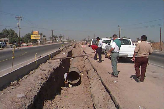
The Imperial Valley Agricultural Drain system comprises over 1,450 miles of constructed surface drains that discharge into the Alamo and New Rivers and the Salton Sea. The Ag Drains primarily carry agricultural runoff from the Imperial Valley. Agricultural discharges in the Imperial Valley range from 830,841 to 1,153,827 AFY, while averaging 994,812 AFY. Of this amount, approximately 44-48% is tailwater, 27-31% percent is tilewater, 13% percent is seepage, and 12% is operational spill. The resulting mix of tailwater (surface runoff), tilewater (subsurface drainage), and seepage contains pesticides, nutrients, selenium, and silt in amounts that exceed water quality standards.
Beneficial Uses
The Federal Clean Water Act and the State Porter-Cologne Water Quality Control Act both require the state to identify “beneficial uses” of water and water quality objectives protective of those uses. The beneficial uses for select waters within the Salton Sea Transboundary Watershed are shown on the following page. The state and federal governments are obligated by law to protect the uses.
| Water Bodies in the Salton Sea Watershed | AGR | AQUA | COLD | FRSH | GWR | IND | MUN | POW | RARE | REC I | REC II | WARM | WILD |
|---|---|---|---|---|---|---|---|---|---|---|---|---|---|
| Alamo River | X | P | X | X | X | X | X | ||||||
| Coachella Valley Drains | X | X | X | X | X | X | |||||||
| Coachella Valley Storm Water Channel4 | X | X | X | X | X | X | |||||||
| Imperial Valley Drains | X | X | X | X | X | X | |||||||
| New River | X | P | X | X | X | X | X | ||||||
| Salton Sea | X | P | X | X | X | X | X | ||||||
| Colorado River and associated lakes and reservoirs | X | X | X | X | X | X | X | X | X | X | X | X |
| CATEGORY | DEFINITION |
|---|---|
| AGR - Agriculture Supply | Uses of water for farming, horticulture, or ranching including, but not limited to, irrigation, stock watering, or support of vegetation for range grazing. |
| AQUA - Aquaculture | Uses of water for aquaculture or mariculture operations including, but not limited to propagation, cultivation, maintenance, or harvesting of aquatic plants and animals for human consumption or bait purposes. |
| COLD - Cold Freshwater Habitats | Uses of water that support cold water ecosystems including, but not limited to, preservation or enhancement of aquatic habitats, vegetation, fish, or wildlife, including invertebrates. |
| FRSH - Freshwater Replenishment | Uses of water for natural or artificial maintenance of surface water quantity or quality. |
| GWR - Ground Water Recharge | Uses of water for natural or artificial recharge of ground water for purposes of future extraction, maintenance of water quality, or halting salt water intrusion into fresh water aquifers. |
| IND - Industrial Service Supply | Uses of water for industrial activities that do not depend primarily on water quality including, but not limited to, mining, cooling water supply, hydraulic conveyance, gravel washing, fire protection, and oil well repressurization. |
| MUN - Municipal and Domestic Supply | Uses of water for community, military, or individual water supply systems including, but not limited to, drinking water supply. |
| POW - Hydropower Generation | Uses of water for hydropower generation. |
| RARE - Preservation of Rare, Threatened, or Endangered Species | Uses of water that support habitats necessary, at least in part, for the survival and successful maintenance of plant or animal species established under state or federal law as rare, threatened or endangered. |
| REC I - Water Contact Recreation | Uses of water for recreational activities involving body contact with water, where ingestion of water is reasonably possible. These uses include, but are not limited to, swimming, wading, water-skiing, skin and scuba diving, surfing, white water activities, fishing, and use of natural hot springs. |
| REC II - Non-Contact Water Recreation | Uses of water for recreational activities involving proximity to water, but not normally involving contact with water where ingestion of water is reasonably possible. These uses include, but are not limited to, picnicking, sunbathing, hiking, beachcombing, camping, boating, tidepool and marine life study, hunting, sightseeing, or aesthetic enjoyment in conjunction with the above activities. |
| WARM - Warm Freshwater Habitat | Uses of water that support warm water ecosystems including, but not limited to, preservation or enhancement of aquatic habitats, vegetation, fish, or wildlife, including invertebrates. |
| WILD - Wildlife Habitat | Uses of water that support terrestrial ecosystems including, but not limited to, the preservation and enhancement of terrestrial habitats, vegetation, wildlife (e.g., mammals, birds, reptiles, amphibians, invertebrates), or wildlife water and food sources. |
WATER QUALITY ISSUES IN THE SALTON SEA TRANSBOUNDARY WATERSHED
Sediment & Attached
Organochlorine Pesticides
Sediment is present in the New and Alamo Rivers and the Imperial Valley Agricultural Drains at levels that impair beneficial uses, including the WILD, WARM, RARE beneficial uses. In addition, and perhaps more importantly, sediment carries long lasting pesticides, including DDT and toxaphene. These pesticides were banned in the 70’s, but are still present at levels of concern within the ecosystem. This is documented through the State’s Toxic Substances Monitoring Program and through studies by the US Fish and Wildlife Service.
Sediment is introduced into the drain system by irrigated agriculture practices, drain management practices such as dredging and bank stability, and through natural channel scouring and bank erosion.
The RWQCB has developed a sediment TMDL for the Alamo River, with a sediment TMDL for the New River to follow soon. A sediment TMDL for the Imperial Valley drains is in development.
Soluble Pesticides
A 5-year study conducted by the State Water Resources Control Board and researchers at the University of California at Davis, found that the organophosphate pesticides diazinon, chlorpyrifos, malathion, and carbofuran were present at toxic levels in the Alamo River and in the Alamo River delta (within the Salton Sea). The RWQCB is implementing a water quality monitoring program to better characterize the temporal and spatial distribution, environmental impacts, and sources of these compounds, along with potential control actions.
Salinity
Currently, the Sea is 25% saltier than the ocean (total dissolved solids concentration of 44,000 milligrams per liter), with salinity increasing at approximately 1% per year. The Sea’s salinity problem cannot be directly addressed from a strictly regulatory standpoint; rather a coordinated solution involving an engineered solution aimed at stabilization and/or restoration of salinity levels must be developed. The Salton Sea Authority and the US Bureau of Reclamation seek to address solutions to this problem in their Environmental Impact State/Report.
Selenium
Selenium is a trace metal that is present in the Colorado River at concentrations of 2 to 5 ppb. The majority of this selenium is introduced into the Colorado River system through land use practices (including mining and agricultural) in Colorado and Utah. Studies by the US Geological Survey documented that all of the selenium contained within the Imperial Valley waterbodies was introduced through irrigation water. Selenium is concentrated through evaporative processes as a result of irrigated agriculture practices, and discharged to Imperial Valley surface waters.
Monitoring data indicate that selenium is present in the Alamo River at approximately 7 to 8 parts per billion (ppb) -- levels that exceed the State’s water quality objective for this water body of 5 ppb. Through the State’s Toxic Substances Monitoring Program, selenium has been detected in fish filets at levels of concern. These data, from 1978 through 1998 are fairly consistent, with no obvious temporal trend present in the data.
The RWQCB intends to begin the long process of addressing the selenium contamination of waters within the Salton Sea Transboundary Watershed through TMDLs, as resources and other priorities permit.
Nutrients
Nutrients are discharged into the surface waters draining to the Salton Sea from agricultural and municipal waste sources in both Mexico, and the U.S. One-hundred years worth of nutrients discharged to the closed basin of the Salton Sea is taking its toll, with eutrophication seen as a major environmental issue for the restoration of the Salton Sea.
The management of nutrient inputs into the closed basin of the Salton Sea is an issue that must be addressed in any meaningful restoration scenario, and one that the RWQCB will play a strong role, through the development and implementation of nutrient TMDLs. This process began in November 2001. RWQCB staff will solicit the input of a scientific advisory committee on issues including data needs, data quality control objectives, model objectives, and numeric targets.
Pathogens
Regional Board staff has measured bacteria levels at the New River delta that exceed the levels established to be protective of human health. The RWQCB is working to address this water quality and human health concern through development and implementation of a pathogen TMDL for the New River. The RWQCB will work cooperatively with the US Environmental Protection Agency and the US International Boundary and Water Commission to achieve implementation of this TMDL.
Volatile Organic Constituents
Volatile organic constituents are routinely detected in the New River at the International Boundary. The sources of these VOCs are believed to be from untreated and partially treated discharges from industry in Mexicali.
Water Quality Control
National Pollutant Discharge Elimination System
Under the Federal Clean Water Act (CWA), all point source discharges of pollutants to waters of the United States (including lakes, rivers, wetlands, etc.) must be authorized under a National Pollutant Discharge Elimination System (NPDES) permit. There are a few exceptions for discharges such as return flows from irrigated agriculture, and runoff from agricultural crop lands and forest lands. Additionally, certain point source discharges of storm water are not currently required to have NPDES permits, although many types of storm water (including storm water discharges associated with industrial activity and construction activity disturbing five or more acres, and discharges from large cities' storm sewer systems) are regulated under the NPDES permit program. Sixteen wastewater treatment facilities with discharges that ultimately flow to the Salton Sea are permitted by the RWQCB.
Total Maximum Daily Loads
Total Maximum Daily Loads (TMDLs) are a requirement of the CWA. A TMDL is the sum of the individual wasteload allocations for point sources, load allocations for nonpoint sources and natural background pollutants, and an appropriate margin of safety. TMDL Implementation Plans may address individual pollutants or groups of pollutants, and should include a description of BMPs, point source controls or other actions necessary to implement TMDL, how and when necessary controls/restoration actions will be accomplished, and who is responsible for implementation.
Imperial County Farm Bureau Voluntary Program
The Imperial County Farm Bureau (ICFB) has initiated a “Voluntary Watershed Program.” Under the direction of a Watershed Coordinator, the ICFB is seeking to establish ten subwatershed (or “drainshed)
groups. Each subwatershed group is to be comprised of individual agricultural producers and landowners who operate/own land within a 50,000 acre drainage basin. The ICFB will encourage owner/operators to take a lead role in the development of subwatershed plans, and to develop and implement BMPs to attain TMDL load allocations.
State’s Nonpoint Source Management Plan
Nonpoint sources (NPS) of water pollution are usually defined as sources which are diffuse and/or not subject to regulation under the federal National Pollutant Discharge Elimination System (for surface water discharges). RWQCB staff work to implement the State Water Resources Control Board NPS Management Plan and to develop and implement Total Maximum Daily Loads for the control of NPS pollution. California’s NPS Pollution Control Program has been in effect since 1988. The Program includes the “Three-Tiered Approach,” through which self-determined implementation is favored, but more stringent regulatory authorities are utilized when necessary to achieve water quality standards. The Three-Tiered approach to NPS regulation includes the following tiers that can be implemented as needed: (1) self-determined implementation of Best Management Practices (BMPs); (2)regulatory-based encouragement of Best Management Practices; and (3) effluent requirements. Through TMDL implementation plans, RWQCB staff are working to provide recommendations to the RWQCB to enhance the effective implementation of the State’s NPS pollution control program.
Best Management Practices
Best Management Practices (BMPs) are defined as “methods, measures, or practices selected by an agency to meet its nonpoint source control needs. BMPs include but are not limited to structural and
nonstructural controls and operation and maintenance procedures. BMPs can be applied before, during, and after pollution-producing activities to reduce or eliminate the introduction of pollutants into receiving waters.” Economic, institutional, and technical factors should be considered in a continuing process of identifying control needs and evaluating and modifying the BMPs as necessary to achieve water quality goals.
Pursuant to the State’s NPS Management Plan, implementation of BMPs should normally include: (1) consideration of specific site conditions; (2) monitoring to assure that practices are properly applied and are effective; (3) improvement of a BMP or implementation of additional BMPs or other management practices when needed to resolve a deficiency and; (4) mitigation of a problem where the practices are not effective.
Salton Sea Restoration Project
There is currently a joint local-federal effort underway to develop alternatives to restore the Salton Sea. The U.S. Bureau of Reclamation and the Salton Sea Authority (a Joint Powers Authority comprised of representatives from Imperial and Riverside Counties, the Coachella Valley Water District, and the Imperial Irrigation District) are the lead agencies. The Federal Salton Sea Reclamation Act of 1998 provided significant funding for the lead agencies to study alternative solutions to restore the Salton Sea. Current efforts focus primarily on salinity reduction/stabilization and stabilization of elevation. Strategic science planning being developed by the Salton Sea Science Subcommittee calls for studies and monitoring of the watershed to better understand the complex relationships between ecosystem health and stressors. A draft EIS/EIR was released in 2001.
New River/Mexicali Sanitation Project
The Regional Board has been actively involved in the cleanup of the NewRiver and has been a significant force in pursuing efforts to addressinternational pollution of the New River. The Regional Board has routinelymonitored the water quality of the New River since 1975. In 1995, the UnitedStates Environmental Protection Agency (USEPA) provided funds to theRegional Board to further monitor and document the water quality at theInternational Boundary on a monthly basis. The main purpose was to assessto what degree Mexican sanitation projects improve water quality of the NewRiver at the boundary. Monitoring data indicate that the New River ispolluted by pesticides, bacteria, silt, nutrients (e.g., nitrate and phosphate), andvolatile organic constituents.
Regional Board staff implements the New River/Mexicali SanitationProgram, which includes: monthly observation tours of discharge locationsand wastewater facilities in the City of Mexicali, Mexico; monthly 8-hourmonitoring and quarterly 24-hour monitoring of the New River at theInternational Boundary; coordination with the U.S. Section of theInternational Boundary and Water Commission; technical reviews ofdocuments, plans and reports; and participation on the binational technicalcommittee.
Pass-Through Grants
RWQCB staff works to solicit, develop, and manage pass-through grant projects that willresult in measurable water quality improvement, that substantially augment planningefforts, and that aim to provide effective education and outreach to the public. Thesegrant monies include the Federal Clean Water Act Sections 205(j) (planning) and 319(h)(implementation) grants. Additionally, Regional Board staff is working to establishrelationships with local, state, and federal agencies to solicit grant money for stakeholderimplementation of water quality improvements. These agencies include the NaturalResources Conservation Service, local Resource Conservation Districts, and the Bureau of Reclamation.
For more information:
Watershed Management and TMDLs: Teresa Newkirk or Joan Stormo
New River/Mexicali Sanitation Program: Doug Wylie or Jose Angel
(760) 346-7491
Visit our website: https://www.waterboards.ca.gov/coloradoriver/
Revised February 2002
