

Supply and Demand Assessment (SDA) – Butte Creek
Overview
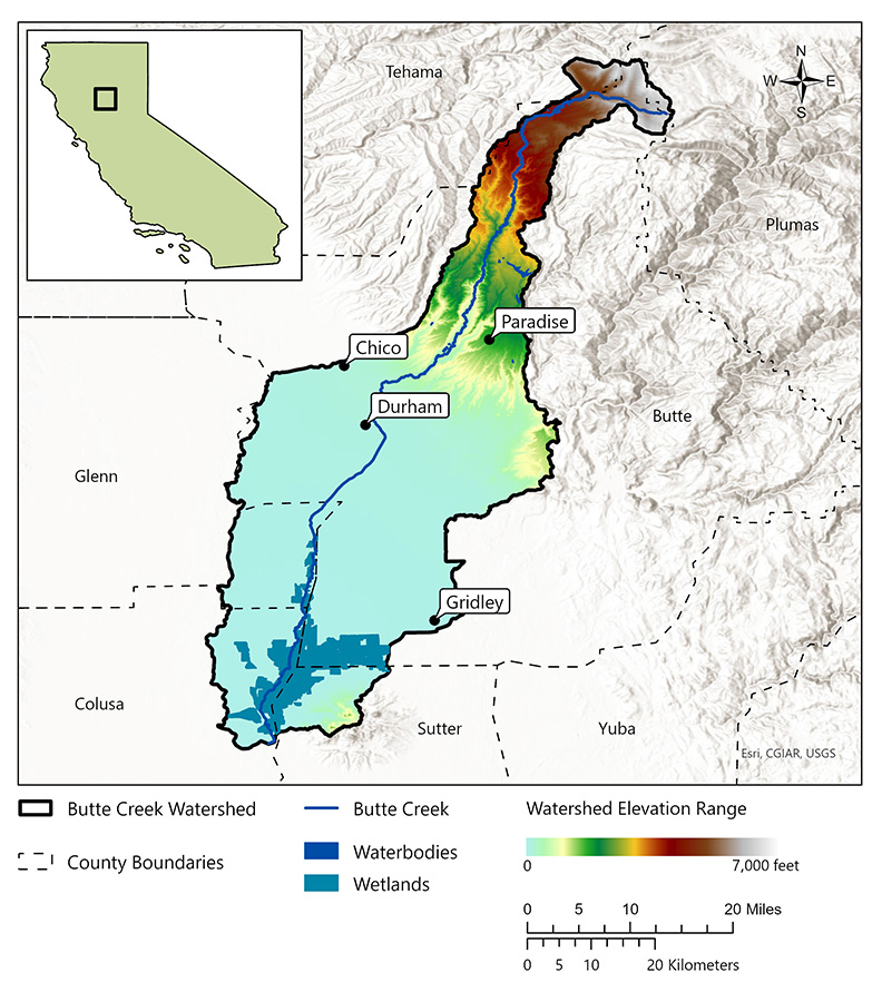
The Butte Creek Watershed is located primarily in Butte County but extends into parts of Tehama, Sutter, Glenn, and Colusa Counties. It is approximately 520,000 acres and ranges in elevation from just above sea level in the lower valley to over 7,000 feet at its headwaters in the western Sierra Nevada Mountains. The watershed has been significantly altered with imported water from the Feather River and numerous diversions for hydropower, municipal, and agricultural uses. The upper watershed, a largely forested area, also contains the PG&E DeSabla-Centerville hydroelectric power plant, which operates two reservoirs, three powerhouses, and a network of dams and canals. The lower watershed is heavily managed for both irrigation water supply and flood control and includes a collection of diversion dams that operate year-round for wildlife, irrigation, and agricultural diversions. Butte Creek is a major tributary to the Sacramento River and provides miles of valuable habitat as the largest run of central valley spring-run chinook salmon, a threatened species listed under both the state and federal Endangered Species Act (ESA). The watershed is also home to the Butte Creek Ecological Preserve, a 93-acre site whose stewardship was transferred to the Mechoopda Indian Tribe of Chico Rancheria in 2022 under AB-379.
- Click on Map to Enlarge
Announcements
- No announcements at this time.
Additional Resources
Supply and Demand Assessment Program Links
Supply and Demand Assessment Information
Project Watersheds:
Stay Informed
Email Subscription List
Subscribe to the SDA Information email topic to receive notifications and the latest updates.
Contact Us
If you have questions or please email them to: DWR-SDA@waterboards.ca.gov
