
Supply and Demand Assessment (SDA) – Napa River
Overview
The Napa River Watershed encompasses approximately 275,000 acres located along the Central Coast Range in Napa County. The watershed ranges in elevation from sea level to roughly 4,000 feet elevation at its headwaters in the Mayacamas Mountains, north of Calistoga. The Napa River is an important freshwater tributary to the San Pablo Bay and supports a diversity of native fish species and wildlife, including coho salmon and steelhead, threatened species under the Federal Endangered Species Act (ESA). In addition to fish and wildlife habitat, the river also offers municipal, domestic, and recreational beneficial uses. There are numerous reservoirs throughout the watershed, including Lake Hennessey, Lake Milliken, and Bell Canyon Reservoir, which in addition to groundwater are relied on heavily to support the region’s needs. The Napa River watershed is also listed under the Clean Water Act 303(d) for impairments to water quality due to nutrients, pathogens, and excessive sedimentation.
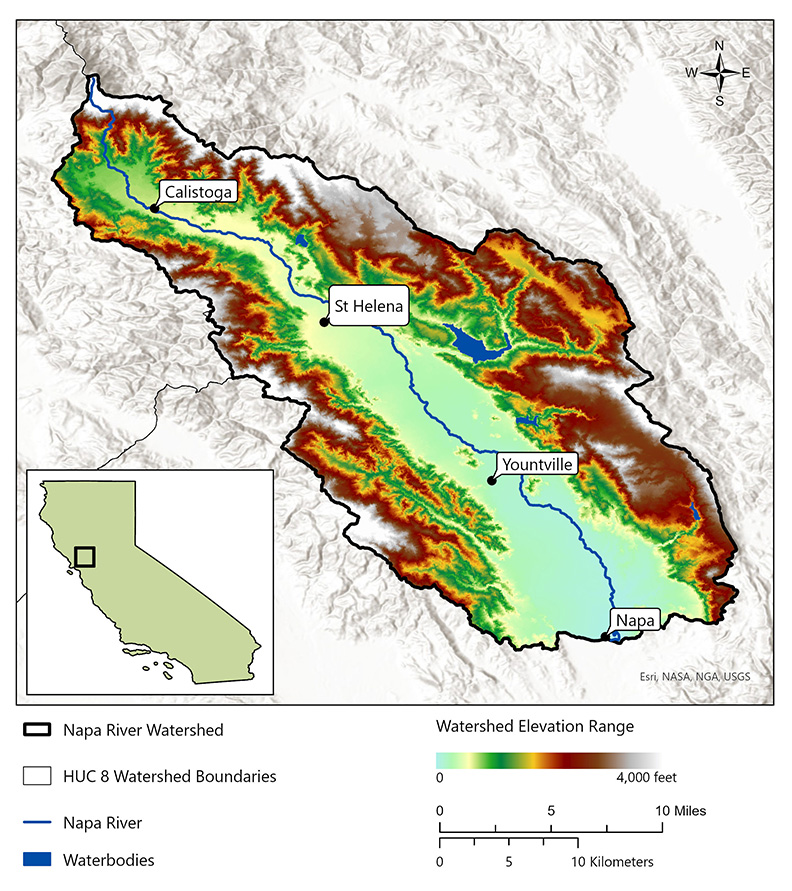
- Click on Map to Enlarge
Announcements
- No announcements at this time.
Additional Resources
Supply and Demand Assessment Program Links
Supply and Demand Assessment Information
Project Watersheds:
Stay Informed
Email Subscription List
Subscribe to the SDA Information email topic to receive notifications and the latest updates.
Contact Us
If you have questions or please email them to: DWR-SDA@waterboards.ca.gov
