
Supply and Demand Assessment (SDA) – Navarro River
Overview
The Navarro River Watershed is the largest coastal watershed in Mendocino County. It encompasses approximately 200,000 acres and ranges in elevation from sea level to over 3,000 feet. The area is sparsely populated and comprised of mostly forestland, rangeland, and agriculture. Water use in this region is characterized by numerous small diversions that support domestic uses and various interests such as viticulture, orchards, and grazing. The Navarro River is largely a natural river, with no dams or large reservoirs on the mainstem. It is also home to important spawning grounds for anadromous fish, particularly coho salmon and steelhead trout, both listed as threatened species under the federal Endangered Species Act (ESA). Primary water issues include low summer flows, excessive sediment concentrations, and high temperatures. The degradation of water conditions in the Navarro River and its tributaries led to the inclusion of the Navarro River in the Clean Water Act 303(d) list for impairments associated with sediment and temperature.
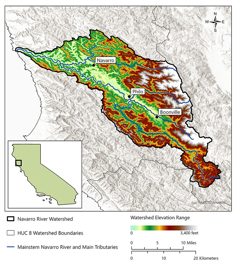
- Click on Map to Enlarge
Announcements
- No announcements at this time.
Additional Resources
Supply and Demand Assessment Program Links
Supply and Demand Assessment Information
Project Watersheds:
Stay Informed
Email Subscription List
Subscribe to the SDA Information email topic to receive notifications and the latest updates.
Contact Us
If you have questions or please email them to: DWR-SDA@waterboards.ca.gov
