Irrigated Lands Program Maps
Well Sampling and Irrigation and Nutrient Management Plan Summary Report (INMP) data
Summary
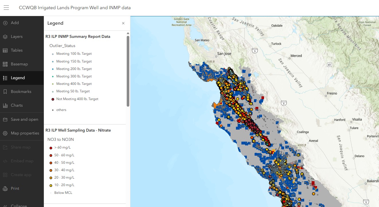
This map includes layers from the Central Coast Regional Water Quality Control Board's (Central Coast Water Board) Irrigated Lands Program (ILP), as well as informational layers sourced from partner agencies. The purpose of this map is to provide an overview of water quality and Irrigation and Nutrient Management Plan (INMP) Summary Report data reported by growers to the Central Coast Water Board in conjunction with other useful metrics, such as the nitrate layer from the Aquifer Risk Map (2024) and the Department of Water Resources' crop map (2023 - Provisional).
For more information, visit CCWQB Irrigated Lands Program Well and INMP data - Overview
