
Surface Water Quality Assessment Program
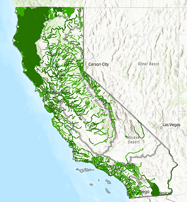
The 2024 California Integrated Report Map is a visualization tool developed to graphically display waterbodies assessed in the Integrated Report. This map is updated after each Integrated Report is approved by the U.S. EPA. Please click on the map for more information and to download shapefiles.
Welcome to the Surface Water Quality Assessment Program Webpage
The federal Clean Water Act (“CWA”) requires that California report on the quality of its surface waterbodies (such as rivers, streams, reservoirs, estuaries, lagoons, bays, and ocean waters) every two years. In order to meet this requirement, California develops the Integrated Report. The Integrated Report consists of the Clean Water Act section 303(d) list of impaired waters and 305(b) condition report. To develop the Integrated Report, data from California surface waters are evaluated and, if appropriate, assessed to determine if they contain pollutants at levels that exceed water quality standards. Development of the Integrated Report is a collaborative process between the State Water Resources Control Board and Regional Water Quality Control Boards and input from the public.
Placing a waterbody on the 303(d) list initiates the prioritization of Total Maximum Daily Load (“TMDL”) development, or another alternative restoration project, to restore and maintain water quality standards. The State Water Resources Control Board adopts the 303(d) list prior to submittal to the U.S. EPA for final approval.
The 305(b) condition report, commonly known as “305(b) report,” assigns an overall water quality condition to all assessed waterbody segments. The 305(b) condition report does not require U.S. EPA approval. However, the U.S. EPA will compile 305(b) reports from states and transmit the summaries in their “National Water Quality Inventory Report” to the United States Congress.
California’s Integrated Report is developed in "cycles" with submittal to the U.S. EPA every two years. Each listing cycle builds on assessments from the previous listing cycle; therefore, each time the Integrated Report is released, it contains all prior statewide assessments as well as any new or revised assessments based on the data received prior to the end of the data solicitation period.
Each Integrated Report cycle consists primarily of data assessments from waters within three Regional Water Quality Control Board regions that are identified in a Notice of Public Solicitation of Water Quality Data. The other six Regional Water Quality Control Boards may assess high-priority data, make listing or delisting recommendations, or propose changes to the 305(b) condition report as an “off-cycle” assessment. The State Water Resources Control Board and the Regional Water Quality Control Boards work in collaboration to develop the Integrated Report. For more information on data submittal for a Notice of Public Solicitation of Water Quality Data, please see Submitting Data and Information for the Integrated Report.
For more information on the Integrated Report, please refer to the Fact Sheet and Frequently Asked Questions (FAQ).
Current, In Progress, and Future Listing Cycles
The following table provides important information about each Integrated Report Cycle. The general timeframes provided are subject to change. For the most up to date information, please subscribe to the State Water Resources Control Boards Integrated Report 303(d)/305(b) email list. For more detailed information and official documentation for each cycle, please select the links for each cycle in the boxes below.
Subscribe to our Integrated Report 303(d)/305(b) Email List email list to receive notifications and the latest updates. After subscribing, you will need to check your email host for a confirmation email to complete the subscription.
Subscribe to our other email lists. See the "Water Quality" section.
Contacts
For general questions about the Integrated Report, please contact us by email: WQAssessment@waterboards.ca.gov
Assessment Tools & Support Unit Lead:
Jessie.Maxfield@waterboards.ca.gov
Assessment Policy & Process Unit Lead:
AnaMaria.Saenz@waterboards.ca.gov
Assessment Data Specialist:
Jacob.Kaplan@waterboards.ca.gov
State Water Resources Control Board Ombudsperson:
opp-contact@waterboards.ca.gov
Data Solicitation
Resources
- Fact Sheet/Hoja Informativa
- Frequently Asked Questions
- Listing Policy
- Impaired Waters Policy
- Historical Integrated Reports
- Total Maximum Daily Load (TMDL) Program
- Water Quality Goals
- Surface Water Ambient Monitoring Program (SWAMP)
- U.S. EPA’s How’s My Waterway
- CA OEHHA’s CalEnviroScreen
- Integrated Report Water Quality Objectives, Criteria, and Evaluation Guidelines
| Cycle | Regions | Milestone |
|---|---|---|
| 2024 (Current Integrated Report) | On-Cycle Regions:
Off-Cycle Regions:
|
Data Solicitation Period : June 29, 2020 – October 16, 2020 Public Review Comment Period: February 16-April 3, 2023 State Board Approval: February 6, 2024 U.S. EPA Partial Approval and Partial Disapproval: December 13, 2024 |
| 2026 (In Progress) | On-Cycle Regions:
Off-Cycle Regions:
|
Data Solicitation Period : April 18, 2022 – October 21, 2022 Public Review and Comment Period: January 30 – April 2, 2025 State Board Approved: February 3, 2026 Submittal to U.S. EPA: March 24, 2026 |
| 2028 (In Progress) | On-Cycle Regions:
Off-Cycle Regions
|
Data Solicitation Period: April 18, 2024 – October 23, 2024 Data Evaluation and Assessment: Winter 2024 – Fall 2026 Public Review and Comment Period: Spring 2027 State Board Consideration: Winter 2027/2028 Submittal to U.S. EPA: Spring 2028 |
| 2030 (In Progress) | On-Cycle Regions:
Off-Cycle Regions
|
Data Solicitation Period: April 10, 2026 – August 10, 2026 Data Evaluation and Assessment: Fall 2026 – Fall 2028 Public Review and Comment Period: Spring 2029 State Board Consideration: Winter 2029/2030 Submittal to U.S. EPA: Spring 2030 |
