
Supply and Demand Assessment (SDA) – Napa River
Overview
The Napa River Watershed encompasses approximately 275,000 acres located along the Central Coast Range in Napa County. The watershed ranges in elevation from sea level to roughly 4,000 feet elevation at its headwaters in the Mayacamas Mountains, north of Calistoga. The Napa River is an important freshwater tributary to the San Pablo Bay and supports a diversity of native fish species and wildlife, including chinook salmon and steelhead, threatened species under the Federal Endangered Species Act (ESA). In addition to fish and wildlife habitat, the river also offers municipal, domestic, and recreational beneficial uses. There are numerous reservoirs throughout the watershed, including Lake Hennessey, Lake Milliken, and Bell Canyon Reservoir, which in addition to groundwater are relied on heavily to support the region’s needs. The Napa River watershed is also listed under the Clean Water Act 303(d) for impairments to water quality due to nutrients, pathogens, and excessive sedimentation.
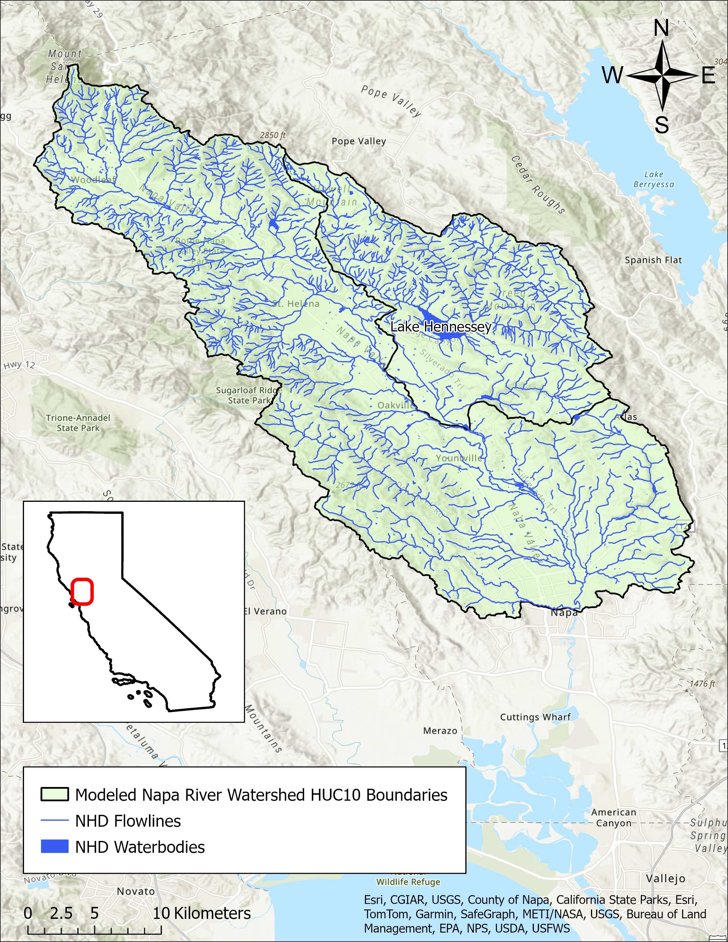
- Click on Map to Enlarge
Announcements
June 18, 2024 - Napa River Watershed Model Work Plan - Now Available
The work plan from Paradigm Environmental for development of a hydrologic model for the Napa River watershed is now publicly available in Model Development section below. Please email questions regarding the model development to DWR-SDA@waterboards.ca.gov.
Model Development
Modeling in the Napa River Watershed
The SDA Unit has continued to work on the models and tools developed for the Russian River Watershed during the State Water Board's 2021-2022 Regional Drought Response. These tools provided the necessary information for the Division of Water Rights (Division) to assess water availability and issue water right curtailments to ensure adequate, minimal water supplies for critical purposes under the emergency regulation.
To capture the water demand in the SDA Program Watersheds, water right demand estimates were incorporated based on information from annual reports of water diversion and use submitted to the Division. The SDA Unit continued to develop the Division’s demand dataset methodology and converted it into a series of R scripts and manual review spreadsheets that apply data quality correction flags. For example, the scripts identified and corrected unit conversion errors, duplicate reporting, and misplotted points of diversion. The SDA Unit then uses a water allocation tool adopted from the UC Davis Drought Water Rights Allocation Tool (DWRAT) to allocate available supply amongst water right holders based on their respective water right priority and water demands. This version of DWRAT allocates water at the subbasin level and accounts for imported flows.
The SDA Unit’s demand methodology, along with the supply scripts and the watershed specific versions of DWRAT, will be made available on the California Water Board Data Center GitHub page as separate repositories.
Additional Resources
Supply and Demand Assessment Program Links
Supply and Demand Assessment Information
Project Watersheds:
Stay Informed
Email Subscription List
Subscribe to the SDA Information email topic to receive notifications and the latest updates.
Contact Us
If you have questions or please email them to: DWR-SDA@waterboards.ca.gov
