SWAMP Achievements Report - Coordination
SWAMP Achevements Quick Links
2015
Statewide Efforts
- Ecohydrology Project - The SWAMP Bioassessment Program is collaborating with USGS, SCCWRP, and Colorado State University on the Ecohydrology project, which will investigate the interaction between flow and ecological integrity.
- Biodiversity Mapping and Conservation Project – The SWAMP Bioassessment Program is collaborating with The Nature Conservancy on the Biodiversity Mapping and Freshwater Conservation project. The goals are to create a database of freshwater biodiversity in California, identify areas of high conservation value, and to assess watershed health and vulnerability .
Regional Efforts
- Sacramento Watershed Coordinated Monitoring Program (Central Valley Region) – The Sacramento Watershed Coordinated Monitoring Program is a collaborative effort between the Department of Water Resources (DWR) Northern Region and Central Valley SWAMP to monitor water quality trends in the Sacramento River watershed. Quarterly monitoring began in the fall of 2008 at 41 sites along the Sacramento River main-stem and at the lower end of tributary streams. Since the start of the program, fifteen additional mid-elevation sites have been added along key tributaries, for a total of 56 monitoring stations. More information is available on the Central Valley SWAMP website and data can be downloaded from DWR’s Water Data Library by selecting “SWCMP”.
- Post-fire Monitoring in the Merced Watershed (Central Valley Region) – With support from SWAMP staff in the Central Valley Water Board Fresno Office, the Upper Merced River Watershed Council monitored five sites in the upper Merced River watershed to evaluate effects of the 2013 Rim Fire.
- Pesticide Reconnaissance Study – SWAMP field crews from four Regional Water Boards (San Francisco Bay, Central Coast, Central Valley, and San Diego) collected samples to support a coordinated pesticide reconnaissance study. The study is being led by the United States Geological Survey and will investigate the presence of new and/or under studied pesticides in California’s surface waters. Twelve monitoring sites were selected to represent agricultural and urban sources of pesticides. Monitoring will continue in 2016.
2014
Regional Efforts
- SWAMP Cyanobacteria Harmful Algal Bloom (CyanoHAB) Program (Multi-Regional Project; San Francisco Bay Region, Central Coast Region and San Diego Region) – SWAMP’s new CyanoHAB program is part of a statewide initiative to develop in-depth monitoring of cyanobacteria blooms and cyanotoxins. This program utilizes satellite imagery, lab data databases and a website with the imagery and lab data, as well as incident reports and bloom information. This program will help ensure that the public is protected and informed.
- Bioassessment Protocol Inter-calibration (San Francisco Bay Region) – In 2014, SWAMP staff in the San Francisco Bay Region continued an exercise designed to ensure that field crews sampling Bay Area streams to fulfill monitoring requirements of the Municipal Regional Stormwater NPDES Permit are collecting comparable data.
- Tembladero Slough Flow Gage Installation (Central Coast Region) – CCAMP and the Elkhorn Slough Foundation have partnered up to maintain flow measurements on the Tembladero Slough.
- Western Shasta County Bioassessment Monitoring (Central Valley Region) – SWAMP is coordinating with the Western Shasta Resource Conservation District to monitor biologic condition in seven streams in Shasta County. These streams are critical to the water quality and health of the cold-water habitat of the Sacramento River below Shasta Dam.
- Battle Creek Watershed Condition (Central Valley Region) – SWAMP is coordinating with the Battle Creek Watershed Conservancy to monitor biologic condition and determine sediment impacts in the Battle Creek Watershed. Battle Creek provides important habitat for anadromous fish, including threatened spring run Chinook salmon and steelhead trout, and is the focus of a large restoration project. These projects will provide important information on trends in stream health and the impacts of local land use activities.
2013
Regional Efforts
- Bioassessment Protocol Inter-calibration (San Francisco Bay Region) – In 2012, SWAMP staff in the San Francisco Bay Region continued an exercise designed to ensure that field crews sampling Bay Area streams to fulfill monitoring requirements of the Municipal Regional Stormwater NPDES Permit are collecting comparable data.
- Mapping of Perennial and Intermittent Streams (Colorado River Basin Region) – A two-year effort to map all perennial and intermittent waterways in the Colorado River Basin Region to a regional geographic information system database.
2012
Statewide Efforts
- Workshop on Freshwater Cyanotoxin Monitoring in California – The Bioaccumulation Oversight Group (BOG) of SWAMP held a two-day workshop in Oakland, CA to educate managers about the potential harmful effects of freshwater cyanotoxins and factors leading to cyanotoxin production.
Regional Efforts
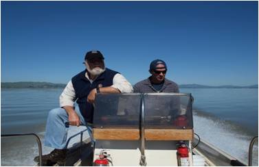
- Bioassessment Protocol Inter-calibration (San Francisco Bay Region) – An exercise facilitated by SWAMP staff in the San Francisco Bay Region that is designed to ensure that field crews sampling Bay Area streams to fulfill monitoring requirements of the Municipal Regional Stormwater NPDES Permit are collecting comparable data.
- Coordinating Nutrient Science in Suisun Bay (San Francisco Bay Region) – An ongoing collaborative effort to coordinate nutrient studies in Suisun Bay. Future development of a Suisun Nutrient Science Plan will ensure that sound management decisions are made regarding the protection of the Bay.
- Regional Monitoring w/ Areas of Special Biological Significance (ASBS) & Stormwater Programs (Central Coast Region) – Central Coast Ambient Monitoring Program (CCAMP) staff is working with multiple agencies to address the impact of discharges on Monterey Bay in line with new regulatory requirements.
- Focusing on Coordination: More SWAMP Partners Enhance Monitoring and Assessment in the San Diego Region (San Diego Region) – The San Diego SWAMP engages in partnerships to coordinate monitoring and assessment activities. Coordination with internal and external partners helps ensure that state-wide and regional monitoring programs are cost-effective and well-informed.
2011
Statewide Efforts
- Regional Monitoring Coalition Creek Monitoring (San Francisco Region) – This project will help determine which streams are in poor condition. It will also begin to identify potential stressors causing the observed ecological degradation.
- Regional Monitoring w/ Areas of Special Biological Significance (ASBS) & Stormwater Program (Central Coast Region) – Several agencies are working together to develop a regional monitoring approach that addresses multiple program requirements and answers important questions about the impact of discharges on Monterey Bay.
- Grassland Bypass Project (Central Valley Region) – A multi-stakeholder effort to manage selenium discharges from the Grassland Drainage Area of the Central Valley.
- Monitoring efforts in the Sacramento-San Joaquin Delta are being coordinated with the Interagency Ecological Program (Central Valley Region) – In 2011, SWAMP expanded the Interagency Ecological Program (IEP) monitoring projects to provide information on cyanobacteria blooms in the Delta, and the sources of pyrethroids to the Cache Slough Complex.
- Safe to Swim Monitoring (Central Valley Region) – SWAMP staff in the Central Valley Region coordinated with the following citizen groups to conduct Safe to Swim monitoring in 2011: Sierra Streams Institute, Dry Creek Conservancy, Tuolumne River Trust, American River Conservancy, Upper Merced River Watershed Group, River Tree Volunteers, and South Yuba River Citizen’s League.
- Bioassessment in the Lake Tahoe Basin (Lahontan Region) – The bioassessment information gathered will allow all entities involved to cost-effectively judge stream health in their jurisdiction or area of interest within the Lake Tahoe Basin.
2010
In 2010, SWAMP published the following documents:Publications
- 2010 Update of the Comprehensive Monitoring and Assessment Strategy to Protect and Restore California's Water Quality (2010 SWAMP Strategy)
This document was published as part of the Water Quality Monitoring Council’s Comprehensive Monitoring and Assessment Strategy. It outlines how SWAMP will coordinate and interact with other Water Board programs and external partners.
- SWAMP Assessment Framework, (SWAMP Strategy, Appendix C)
The Assessment Framework is a guidance document that will be used to assist other Water Board programs in designing monitoring programs that answer their management questions. The objective is to get data from other programs to be comparable with SWAMP.
SWAMP Partners
Biological Objectives Policy Advisory GroupsThree advisory groups provide staff input into the development of biological objectives for California perennial streams and rivers project: the Stakeholder, Scientific, and Regulatory Advisory Groups. The Stakeholder and Scientific Advisory Groups were formed in 2010. The Regulatory advisory Group will be formed by summer 2011.
 California Water Quality Monitoring Council
SWAMP has played a key role in the implementation of California SB 1070, which called for the creation of the California Water Quality Monitoring Council (CWMC), as well as continuing to provide staff and funding for its initial products. SWAMP hosts the “My Water Quality” website, which provides accessible, meaningful information on the five themes of Safe to Eat Fish, Safe to Swim, Safe to Drink, Ecosystem Health, & Stressors. In 2011 SWAMP produced an update to its monitoring and strategy in combination with the release of the Monitoring Council’s Comprehensive Monitoring Program Strategy, appearing as an appendix to the Monitoring Council document. In addition, SWAMP serves in wide variety of roles by participating in the various theme-specific workgroups of the Monitoring Council.
 California Environmental Data Exchange Network Regional Data Centers
The California Environmental Data Exchange Network (CEDEN) is a collaborative effort among many federal, state and local agencies in California who want to provide a centralized location for storing and retrieving environmental water quality data. The CEDEN system uses a Regional Data Center concept, which means that a local contact for a designated region of California (or an agency specializing in your type of monitoring program) is available to assist data providers in getting their data into the CEDEN system. Once the data is in the CEDEN centralized system, the data providers are still considered the owners of the data and can modify or make adjustments at any time. Currently, there are four Regional Data Centers within California: Central Coast Regional Data Center, Central Valley Regional Data Center, San Francisco Regional Data Center, and Southern California Regional Data Center.
 California Department of Fish and Wildlife
The Department of Fish and Wildlife maintains native fish, wildlife, plant species and natural communities for their intrinsic and ecological value and their benefits to people. This includes habitat protection and maintenance in a sufficient amount and quality to ensure the survival of all species and natural communities. Scientists from the California Department of Fish and Wildlife (DFW) serve on the SWAMP Roundtable and on various workgroups assisting with study design and implementation. DFW scientists participate in statewide and regional SWAMP monitoring programs such as the Bioassessment Monitoring Program.
 California Office of Health Hazard Assessment
Staff from the Office of Environmental Health Hazard Assessment (OEHHA) participate in the SWAMP Roundtable and serve on the Bioaccumulation Oversight Group providing guidance on the study design for studies of contaminants in sport fish statewide. OEHHA uses SWAMP data in their development of fish consumption advisories and safe eating guidelines.
 US Environmental Protection Agency
The US Environmental Protection Agency (US EPA) serves multiple roles in water quality protection. The US EPA provides a significant amount of the funding to support the statewide assessments and quality assurance, data management, and program coordination infrastructure integral to the SWAMP program. Additionally, SWAMP partners with the US EPA to participate in a variety of national monitoring activities, adding value to both statewide and national water quality assessments. US EPA has also funded development of a San Joaquin Monitoring Strategy and supported development of the Central Valley Monitoring Strategy.
 San Francisco Estuary Institute
The San Francisco Estuary Institute scientists serve on the Bioaccumulation Oversight Group and conduct the monitoring for the SWAMP Bioaccumulation Monitoring Program. Additionally, SFEI hosts one of the SWAMP Regional Data Networks that consolidate and integrate ambient monitoring water quality data into the California Environmental Data Exchange Network (CEDEN). This provides users of the State’s ambient monitoring data with a standardized system for the data and promotes a more comprehensive understanding of the status, trends, and environmental processes and mechanisms in California. SFEI is also involved with several ongoing water quality projects in the regions including monitoring in the San Joaquin River and development of the Central Valley Monitoring Directory.
 Southern California Coastal Water Research Project
The Southern California Coastal Water Research Project (SCCWRP) is a research institute focusing on the coastal ecosystems of Southern California from watersheds to ocean. SCCWRP was formed in 1969 to enhance the scientific understanding of linkages among human activities, natural events, and the health of the Southern California coastal environment; to communicate this understanding to decision makers and other stakeholders; and to suggest strategies for protecting the coastal environment of this and future generations. They have partnered with SWAMP on many projects including housing a Regional Data Center, development of sediment quality objectives, development of a bioassessment quality assurance program plan, and conducting research to support the designation of 34 areas of biological significance.
 Moss Landing Marine Laboratories, Marine Pollution Studies Laboratory
Moss Landing Marine Laboratories (MLML) assist with data interpretation, water and sediment toxicity testing, and toxicity data management tasks. The SWAMP toxicity database grew out of the Marine Protection Studies Laboratory data management program at MLML. Scientists also participate in program planning committees, and have organized and facilitated external scientific review for SWAMP. MLML hosts the Data Management Information Site for SWAMP. They also provide a link to the California Environmental Data Exchange Network (CEDEN) where SWAMP data is being combined with other data from around the state and is increasingly being made available for public use.
 California Department of Fish and Wildlife, Aquatic Bioassessment Laboratory
The mission of the Aquatic Bioassessment Laboratory (ABL) is to support the use of biology in California's water quality management and assessment programs. The Aquatic Bioassessment Laboratory has been a key partner in developing tools for bioassessment, biological indicators, and reference conditions for streams. Staff scientists also participate as members of the SWAMP Roundtable.
 U.C. Davis Marine Pollution Studies Laboratory at Granite Canyon
The scientists at Granite Canyon Laboratory assist with the program design, data interpretation, water and sediment toxicity testing, and toxicity data management tasks.
 Cal/EPA Environmental Indicators Development Team
SWAMP participated in the Cal/EPA Environmental Indicators Development Team and in the development of the Sediment Quality in California Bays and Estuaries Report which provides an assessment framework that provided a more comprehensive and robust assessment of statewide sediment quality than had been achieved previously. This study’s assessment of sediment conditions on both statewide and regional scales can be used as a benchmark for future studies.
 U.C. Davis Aquatic Health Program, Aquatic Toxicology Lab
The Aquatic Toxicology Laboratory (ATL) is a State-certified lab with over 20 years of experience in investigating surface water quality and aquatic ecosystem health in watersheds throughout California. ATL activities focus on conducting aquatic organism toxicity tests, as defined by the United States Environmental Protection Agency (US EPA), using standard as well as resident aquatic species.
Effective Coordination of Monitoring and Assessment in the San Diego River Watershed
This project coordinates the monitoring of water quality in San Diego River watershed with the goal of developing a cost effective and integrated monitoring program. Such coordination will improve the assessment of water bodies in the San Diego River watershed. The project brings together all stakeholders within the San Diego River watershed. The project serves as a pilot study for the San Diego region. Most of the watersheds in the San Diego region are in need of an integrated and coordinated monitoring program. If the proposed study is successful, efforts will be made to coordinate watershed monitoring in other watersheds in the San Diego region.
 Klamath Basin Monitoring Program
This group has a wide range of partners, including both State and Federal entities, Tribal governments, Citizen Monitoring groups, private and public companies, and others; addressing a variety of questions such as Salmon Restoration, dam removals, protecting Tribal community needs, fish disease research, and blue-green algae. SWAMP has future plans to assist this group with data base enhancement.
 San Francisco Estuary Regional Monitoring Program
The RMP is a collaboration between Bay Area dischargers, SWAMP, and SFEI. The RMP provides scientifically rigorous chemical and physical data for water, sediment, and biota. The RMP’s objectives include: describing patterns and trends in contaminant transport; describing pollutant general sources, pathways, and loadings; and measuring contaminant effects on the Bay’s ecosystems. Information from the RMP is critical to the development of several TMDLs for San Francisco Bay. The RMP provides an open forum for interested parties to communicate about contaminant issues facing the Bay and produces a yearly status and trend report (The Pulse).
Delta Water Quality – Comprehensive Monitoring Program
The Water Boards’ Strategic Workplan for Activities in the San Francisco Bay/ Sacramento - San Joaquin Delta Estuary (2008) identified the design and implementation of a comprehensive monitoring program for the Delta as a priority action. The program would develop a framework for regularly compiling and synthesizing information collected by a diverse array of agencies and other entities into assessments of the water quality in the Delta. SWAMP staff and resources help support the planning team’s (Central Valley and State Water Boards, the Aquatic Science Center, and Dr. Brock Bernstein) efforts to develop the regional monitoring program using a phased approach and a collaborative stakeholder process.
Sacramento Watershed Coordinated Monitoring Program
The Sacramento Watershed Coordinated Monitoring Program (SWCMP) is a collaborative monitoring effort between the Central Valley Water Board SWAMP and Department of Water Resources (DWR) Northern District. The Central Valley Water Board is leveraging SWAMP funding to maintain and expand DWR trend monitoring in Northern California. The SWCMP is part of a SWAMP plan to monitor seasonal and spatial trends at a network of sites across the Central Valley. Eleven of the sites are being coordinated with SWAMP Statewide Stream Pollution Trend Monitoring at Integrator Sites, a statewide study to monitor contaminant trends in sediment.
 Grassland Bypass Project
The Grassland Bypass Project (GBP) prevents subsurface agricultural drainage water high in selenium and salts from being discharged to wildlife refuges and wetland areas in central California. Since 2000, the Central Valley Water Board SWAMP has supported field crews to collect weekly samples to monitor the compliance of the GBP with a Waste Discharge Requirement issued by the Central Valley Regional Water Board. In addition, SWAMP incorporates GBP monitoring data into the SWAMP database, for integration into CEDEN.
 San Joaquin River Restoration Program
The San Joaquin River Restoration Program (SJRRP) is a comprehensive long-term effort to restore flows and a self-sustaining salmon fishery to the San Joaquin River. SWAMP is coordinating with SJRRP in developing their monitoring plan and is supporting bioassessment monitoring using benthic macroinvertebrates on the San Joaquin River. The objective of the bioassessment monitoring is to establish the baseline condition of the river and document impacts of the restoration activities.
 Stormwater Monitoring Coalition
The Stormwater Monitoring Coalition (SMC) is partnering with SWAMP as one of the first programs to incorporate the use of biological assessment into their permitting process. The SMC is a coalition of stormwater management agencies that include the State Water Board, the Los Angeles, Santa Ana, and San Diego Regional Water Boards, Caltrans, the Cities of Long Beach and Los Angeles, the counties of Orange, San Diego, Los Angeles, Riverside, San Bernardino, and Ventura, the Southern California Coastal Water Research Project, and the US Environmental Protection Agency (US EPA).
Council for Watershed Health - Los Angeles River Watershed
The Los Angeles River Watershed Monitoring Program (LARWMP) was developed during 2007 by a group of stakeholders representing major permittees, regulatory and management agencies, and conservation groups. The objectives of the program are to increase awareness of the importance of issues at the watershed scale and to improve the coordination and integration of monitoring efforts for both compliance and ambient conditions.
 Natural Resource Projects Inventory
The Natural Resource Projects Inventory (NRPI) is the most comprehensive statewide database of its kind in California with over 6,000 natural resource projects searchable on the Internet. These projects include watershed conservation and acquisition, restoration and noxious weed eradication, assessment, planning, and scientific studies.
San Gabriel River Regional Monitoring Program
The San Gabriel River Regional Monitoring Program (SGRRMP) seeks to answer core water quality monitoring questions to achieve multiple objectives, increase awareness of issues at the watershed scale and improve the coordination and integration of monitoring efforts for both compliance and ambient conditions. SWAMP partnered and supported ambient water quality monitoring activities in this watershed. The resulting program is a multi-level monitoring framework that combines probabilistic and targeted sampling for water quality, toxicity, and bioassessment.
 Southern California Bight Regional Monitoring Program
SWAMP collaborates with the Southern California Coastal Water Research Project (SCCWRP) and the Bight Regional Monitoring Program to improve the efficacy of existing monitoring programs and improve capacity for regional assessments. This program conducts an integrated assessment of the southern California coastal ocean and provides a comprehensive assessment of the ecological condition of the Southern California Bight focusing on coastal ecology, shoreline microbiology, and water quality.
Central Valley Monitoring Directory
The Central Valley Monitoring Directory provides access to program and metadata for current water quality monitoring efforts in the Central Valley watershed. The directory has been developed to help improve the coordination and integration of existing monitoring efforts. Monitoring information is accessed through an interactive map and forms. Links to actual water quality data (hosted elsewhere) have been provided when available.
![]() State and Federal Contractors Water Agency
State and Federal Contractors Water Agency
The State and Federal Contractors Water Agency (SFCWA) was formed in August of 2009 as a Joint Powers Authority under California law by various water agencies that receive water transported across the Sacramento-San Joaquin River Delta by the State Water Project and Central Valley Project. The organization’s mission is to assist its member agencies in assuring a sufficient and reliable high-quality water supply for their customers from the State Water Project and federal Central Valley Project. The core focus of activities in pursuing this mission is centered on facilitating habitat conservation measures and research related to the restoration of the Delta ecosystem while assuring sufficient and reliable export water supplies. In 2011 SFCWA partnered with the San Francisco Bay Regional SWAMP to conduct a study of the impacts from ammonia on algae production in Suisun Bay.
SWRCB Oceans Division: Areas of Special Biological Significance
The Areas of Special Biological Significance (ASBS) were established by the State Board in the mid-1970s to provide special protection for valuable or sensitive marine life. There are 34 ASBS which extend along roughly 500 miles (32%) of the state shoreline. SWAMP funded two studies regarding ambient water quality in ASBS: a pilot study to identify ‘natural water quality’ reference conditions, and a statewide study evaluating the impact of storm events on ASBS, both near and far from direct discharges. The pilot study tested the methodology for sampling reference areas which may be used to define natural water quality.
 Romberg Tiburon Center
Mission – To advance understanding of the world’s complex marine and estuarine environments through research, education, and outreach, with a focus on San Francisco Bay.
 U.S. Geological Survey
The United States Geological Survey (USGS) is a scientific agency of the United States government. The scientists of the USGS study the landscape of the United States, its natural resources, and the natural hazards that threaten it. The organization has four major science disciplines, concerning biology, geography, geology, and hydrology. The USGS is a fact-finding research organization with no regulatory responsibility. USGS biologists are working with SWAMP, the Department of Fish and Wildlife, and SCCWRP on the modeling needed to develop biological objectives for California's perennial, wadeable streams.
State Water Board Program Partners
 Irrigated Lands Regulatory Program
- Bay-Delta Program
San Francisco Bay/Sacramento - San Joaquin Delta Estuary Program
- Dredge/Fill (401) and Wetlands Program
- Clean Water Team - Citizen Monitoring
Citizen Monitoring of the Surface Water Ambient Monitoring Program - Nonpoint Source Pollution Control Program
- NPDES Permitting Program
- Ocean Standards Program
- Areas of Special Biological Significance (ASBS)
- Storm Water Program
- Total Maximum Daily Load Program
- Grants Projects
Questions or Comments?
- Please direct inquiries to the State Water Board, Surface Water Ambient Monitoring Program (SWAMP).
- State and Regional Board contacts listing: https://www.waterboards.ca.gov/water_issues/programs/swamp/swamp_contacts.html

