



Supply and Demand Assessment (SDA) - San Lorenzo River
Overview
The San Lorenzo Watershed is a coastal watershed located within Santa Cruz County that drains approximately 137 square miles. Its elevation ranges from near sea level to roughly 2,953 feet. Characterized by a Mediterranean climate with distinct wet and dry seasons, the watershed receives an average of 47 inches of rainfall each year. The main land cover of the watershed consists of forests, developed areas, open space, and grasslands. The San Lorenzo River provides 54% of the drinking water for the City of Santa Cruz. The watershed also supports key habitat for anadromous fish and the tidewater goby—species that have been affected by elevated sediment levels. These ecological pressures prompted the development of Total Maximum Daily Loads (TMDLs) for sediment and other pollutants between 2000 and 2014. In response, the San Lorenzo Valley Water District has partnered with local programs to reduce sedimentation, improve water quality, and protect the watershed's natural resources.
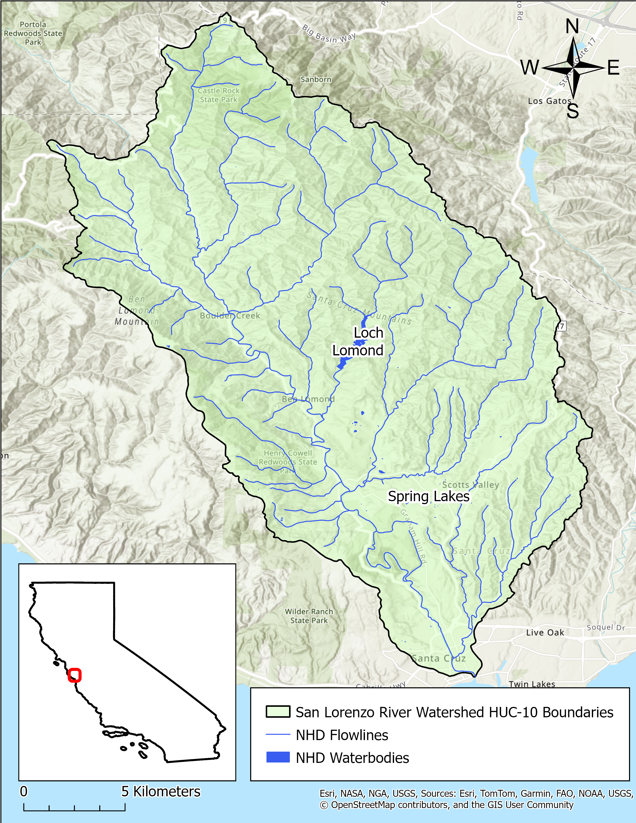
- Click on Map to Enlarge
Announcements
May 27, 2026 - San Lorenzo River Watershed Model Work Plan - Now Available
The work plan from Paradigm Environmental for development of a hydrologic model for the San Lorenzo River watershed is now publicly available in Model Development section below. Please email questions regarding the model development to DWR-SDA@waterboards.ca.gov.
Model Development
- San Lorenzo River Watershed Model Work Plan
- Details watershed background, hydrology, and guidelines/initial steps for model development process
Outreach and Engagement
- San Lorenzo River Watershed Fact Sheet Coming Soon
Modeling in the San Lorenzo River Watershed
The SDA Unit has continued to work on the models and tools developed for the Russian River Watershed during the State Water Board's 2021-2022 Regional Drought Response. These tools provided the necessary information for the Division of Water Rights (Division) to assess water availability and issue water right curtailments to ensure adequate, minimal water supplies for critical purposes under the emergency regulation.
To capture the water demand in the SDA Program Watersheds, water right demand estimates were incorporated based on information from annual reports of water diversion and use submitted to the Division. The SDA Unit continued to develop the Division's demand dataset methodology and converted it into a series of R scripts and manual review spreadsheets that apply data quality correction flags. For example, the scripts identified and corrected unit conversion errors, duplicate reporting, and misplotted points of diversion. The SDA Unit then uses a water allocation tool adopted from the UC Davis Drought Water Rights Allocation Tool (DWRAT) to allocate available supply amongst water right holders based on their respective water right priority and water demands. This version of DWRAT allocates water at the subbasin level and accounts for imported flows.
The SDA Unit's demand methodology, along with the supply scripts and the watershed specific versions of DWRAT, will be made available on the California Water Board Data Center GitHub page as separate repositories.
Supply and Demand Assessment Program Links
Supply and Demand Assessment Information
Project Watersheds:
Stay Informed
Email Subscription List
Subscribe to the SDA Information email topic to receive notifications and the latest updates.
Contact Us
If you have questions or please email them to: DWR-SDA@waterboards.ca.gov

