



Supply and Demand Assessment (SDA) - Trinity River
Overview
The Trinty River watershed is located within Trinity and Humboldt Counties and has two main branches, Trinity River and South Fork Trinity River. The Trinity River extends south from Trinity Lake and curves westward toward the South Fork Trinity River. The South Fork Trinity River originates in the North Yolla Bolly mountains about 50 miles southwest of Redding and continues northwest for approximately 90 miles before reaching its confluence with the Trinity River near Salyer. The South Fork Trinity River is California's longest Wild and Scenic River. The overall watershed covers approximately 2,970 square miles, and its elevation ranges from 194 feet to 8,530 feet. The watershed has a Mediterranean climate with distinct wet and dry seasons, and the land cover is mainly forest and shrubland.
The Trinity River watershed represents an important habitat for native species and is a spawning ground for anadromous fish, especially the spring Chinook, as well as steelhead trout and coho salmon. Increased sediment caused declines in the salmonid population over time. As a result, the U.S. EPA and North Coast Regional Water Quality Control Board established a Total Maximum Daily Load (TMDL) for sediment in 1992 for the Trinity River and in 2001 for the South Fork Trinity. Due to this, the Trinity River has seen a variety of restoration efforts.
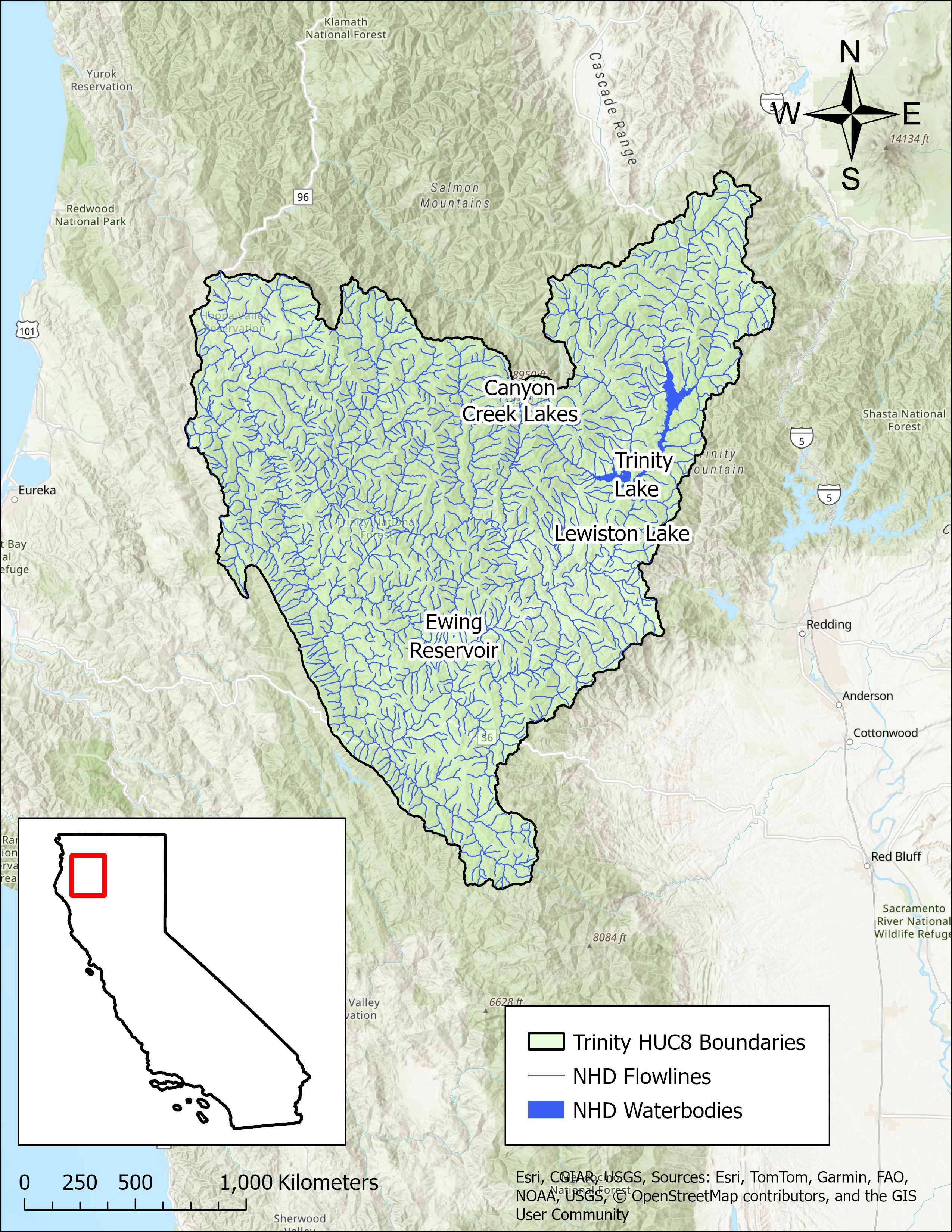
- Click on Map to Enlarge
Announcements
May 27, 2026 - Trinity River Watershed Model Work Plan - Now Available
The work plan from Paradigm Environmental for development of a hydrologic model for the Trinity River watershed is now publicly available in Model Development section below. Please email questions regarding the model development to DWR-SDA@waterboards.ca.gov.
Model Development
- Trinity River Watershed Model Work Plan
- Details watershed background, hydrology, and guidelines/initial steps for model development process
Outreach and Engagement
- Trinity River Watershed Fact Sheet Coming Soon
Modeling in the Trinity River Watershed
The SDA Unit has continued to work on the models and tools developed for the Russian River Watershed during the State Water Board's 2021-2022 Regional Drought Response. These tools provided the necessary information for the Division of Water Rights (Division) to assess water availability and issue water right curtailments to ensure adequate, minimal water supplies for critical purposes under the emergency regulation.
To capture the water demand in the SDA Program Watersheds, water right demand estimates were incorporated based on information from annual reports of water diversion and use submitted to the Division. The SDA Unit continued to develop the Division's demand dataset methodology and converted it into a series of R scripts and manual review spreadsheets that apply data quality correction flags. For example, the scripts identified and corrected unit conversion errors, duplicate reporting, and misplotted points of diversion. The SDA Unit then uses a water allocation tool adopted from the UC Davis Drought Water Rights Allocation Tool (DWRAT) to allocate available supply amongst water right holders based on their respective water right priority and water demands. This version of DWRAT allocates water at the subbasin level and accounts for imported flows.
The SDA Unit's demand methodology, along with the supply scripts and the watershed specific versions of DWRAT, will be made available on the California Water Board Data Center GitHub page as separate repositories.
Supply and Demand Assessment Program Links
Supply and Demand Assessment Information
Project Watersheds:
Stay Informed
Email Subscription List
Subscribe to the SDA Information email topic to receive notifications and the latest updates.
Contact Us
If you have questions or please email them to: DWR-SDA@waterboards.ca.gov

