
GAMA Online Tools
The State Water Board GAMA Program and the U.S. Geological Survey have created tools to help users understand groundwater quality in California. The following online tools allow users to access data through web maps and data querying tools.
Recommended browser is Google Chrome. If you have any problems when using these tools, please contact GAMA staff.
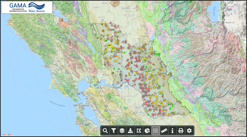
GAMA Groundwater Information System
- The GAMA Program’s online groundwater information system integrates and displays groundwater quality data from several different sources on an interactive Google-based map interface. This system provides access to approximately 87 million analytical results from over 290,000 wells in California. Analytical tools and reporting features help users assess groundwater quality and identify potential groundwater issues in California.
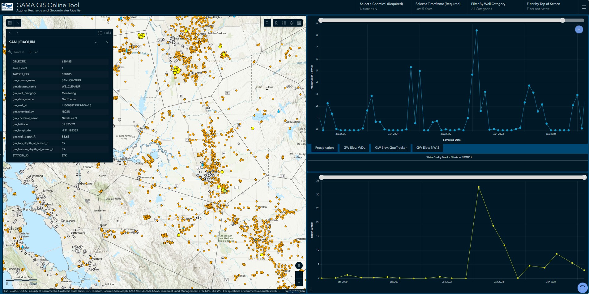
Aquifer Recharge and Groundwater Quality (ARGQ) Dashboard
- The Aquifer Recharge and Groundwater Quality (ARGQ) Dashboard is a tool developed to assist individuals and agencies with the visualization of potential correlations between water quality and groundwater recharge events, such as the heavy precipitation from Atmospheric River events that impacted California during the winter of 2022-2023. The primary purpose of this tool is to allow users to view charts of water quality results from wells alongside historic precipitation and groundwater elevation data, as well as view other data layers relevant to groundwater recharge.
Well Vulnerability Assessment Tool
The Well Vulnerability Assessment Tool (WVAT) is intended to give well owners and water managers possible reasons for the occurrence of certain contaminants and to highlight potential sustainability issues based on broadly applied statistical interpretations of geochemical and isotopic tracers. These assessments can help decision makers understand area groundwater quality concerns and vulnerabilities to their resource.
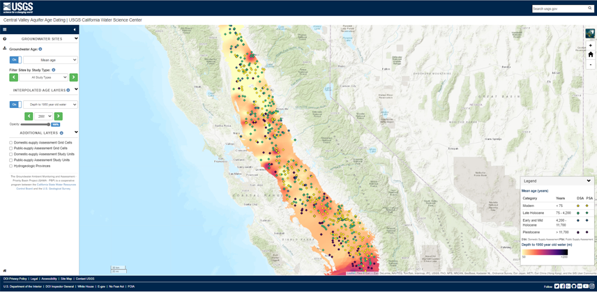
Central Valley Aquifer Age Dating
- Modern, shallow groundwater in California’s Central Valley can contain elevated concentrations of nitrate and other anthropogenic contaminants. As that water moves deeper into the aquifer, it moves into the zone tapped by wells that supply drinking water. This USGS web application presents a new model of the Central Valley that allows users to predict how this front of modern water will move deeper into the aquifer across the whole basin. It identifies the depth of water that was recharged before and after 1950 using multiple geochemical tracers collected from domestic and public drinking-water-supply wells. Outputs map how the modern/premodern interface moves in three dimensions through time. This study is a product of the statewide Groundwater Ambient Monitoring and Assessment Program-Priority Basin Project (GAMA-PBP), a cooperative partnership between the USGS and the California State Water Resources Control Board.
Trend Analysis Tool
- The U.S. Geological Survey trends analysis tool allows the user to observe trends in 38 inorganic constituents from the GAMA Priority Basin Project, alongside the same inorganic constituents from the Division of Drinking Water public supply drinking water data. Several tools to analyze trends are included, as well as the ability to differentiate between statistically-significant increasing or decreasing trends, and trends dependent of well depth.
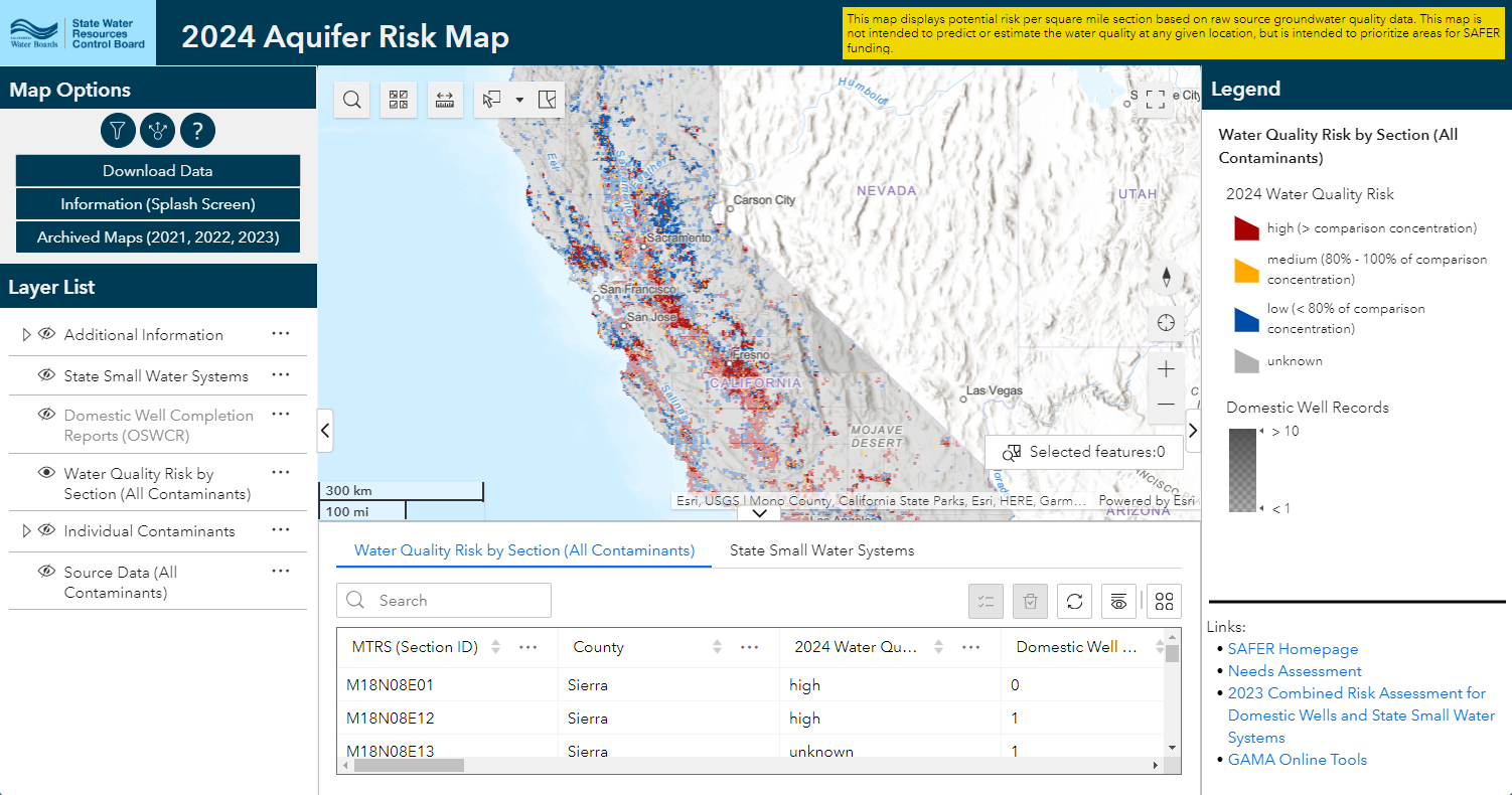
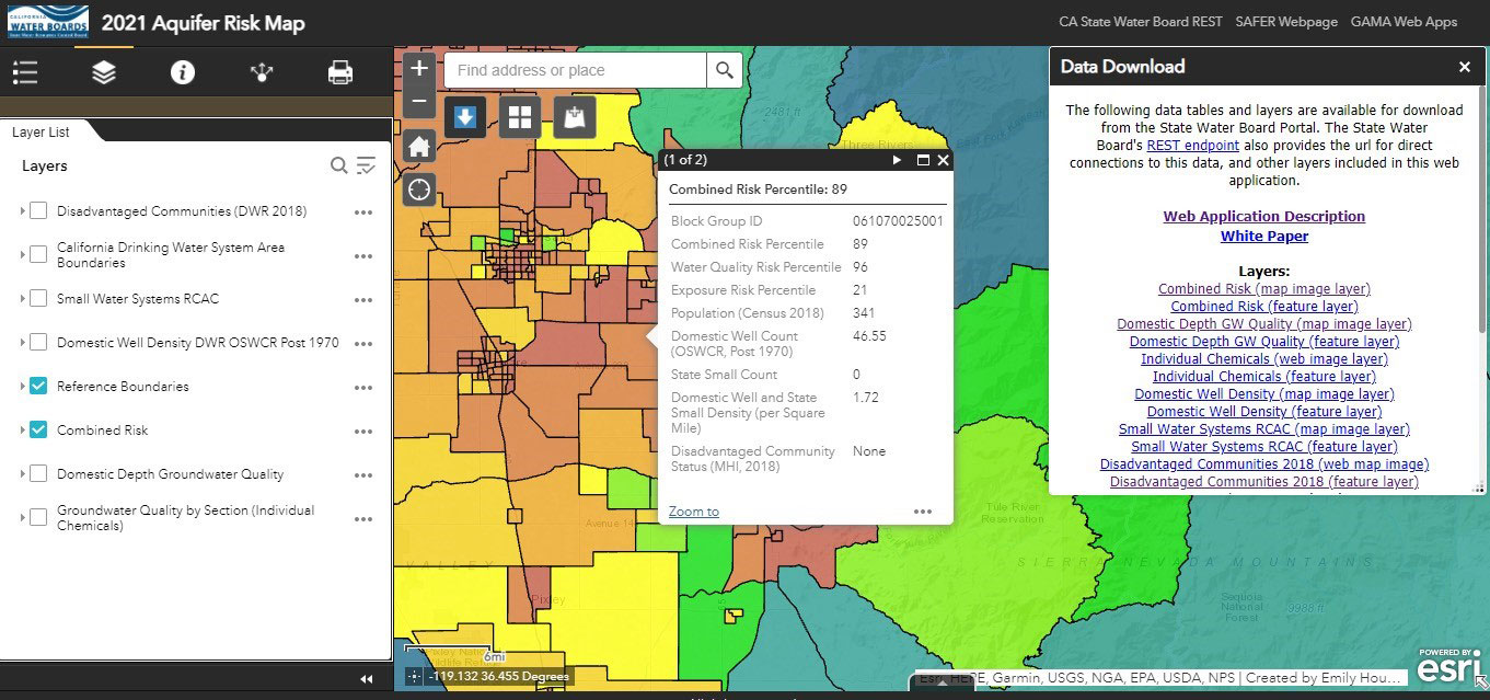
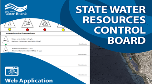
Aquifer Risk Map for Domestic Wells and State Small Water Systems
- The Aquifer Risk Map is an interactive web tool designed to identify areas of the state where domestic wells (serving less than five connections) and state small water systems (serving between 5 and 15 connections) may be at a relatively higher risk of accessing groundwater that does not meet primary drinking water standards. The aquifer risk map was developed to fulfill requirements included in Senate Bill 200 (Monning, statues of 2019) and is a component of California’s Safe and Affordable Funding for Equity and Resilience (SAFER) program. The primary purpose of this map interface is to inform Water Boards staff in support of the SAFER annual Fund Expenditure Plan. In accordance with SB 200, the Aquifer Risk Map will be updated on an annual basis. See the white paper presenting the methodology behind this map. See the SAFER program for additional information.
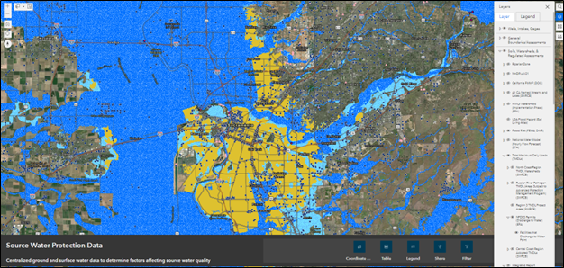
Source Water Protection Web Application (aka "SWP Data Hub")
- This web application provides an online, publicly available, centralized location for ground and surface water spatial data. This includes groundwater source well locations, surface water intakes, vulnerability assessments, nearby potentially contaminating activities, and other data relevant to source water protection. The Division of Drinking Water is currently developing a tool to assess potentially contaminating activities at a defined distance, for purposes of creating a source water assessment.
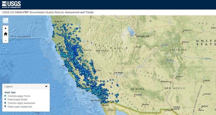
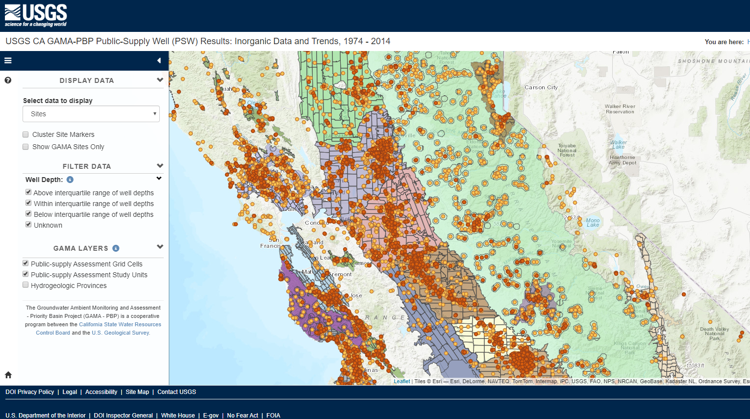
U.S. Geological Survey Groundwater Quality Mapping Tool
- The U.S. Geological Survey has created the Groundwater Quality Results Mapping Tool. This interactive web map plots water-quality data from domestic and public-supply wells sampled by the USGS for the California GAMA Priority Basin Project, and allows users to download datasets.
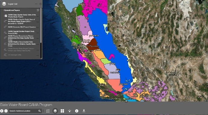
GAMA Program Publications Web Application
- The GAMA Program Publications Web Application provides spatial views and links to data, publications, and connections to the various projects in the GAMA program. New in this update is the inclusion of online journals.
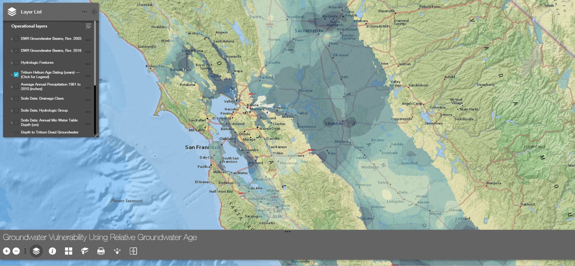
Groundwater Vulnerability Using Relative Groundwater Age
- This tool is intended to provide a knowledge of relative groundwater age across California, using the tritium-helium dating technique employed by the GAMA Program work with the LLNL, previously published. It allows the user to analyze relative groundwater age of the tritium-containing groundwater (young portion) to observe vulnerability to groundwater contamination via recharge.
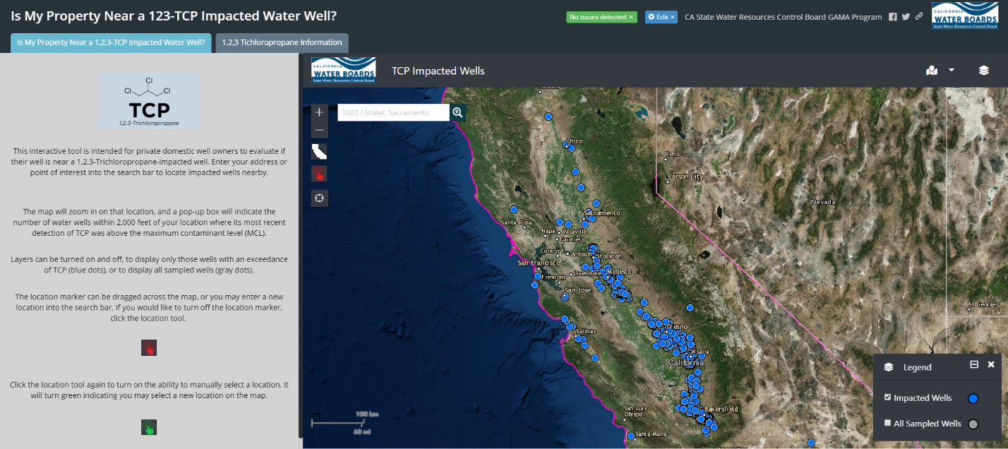
Is My Property Near a 123-TCP Impacted Water Well?
- This interactive tool is intended for private domestic well owners to evaluate if their well is near a 1,2,3-Trichloropropane-impacted well. Enter your address or point of interest into the search bar to locate impacted wells nearby. Additional information about 123-TCP is provided.
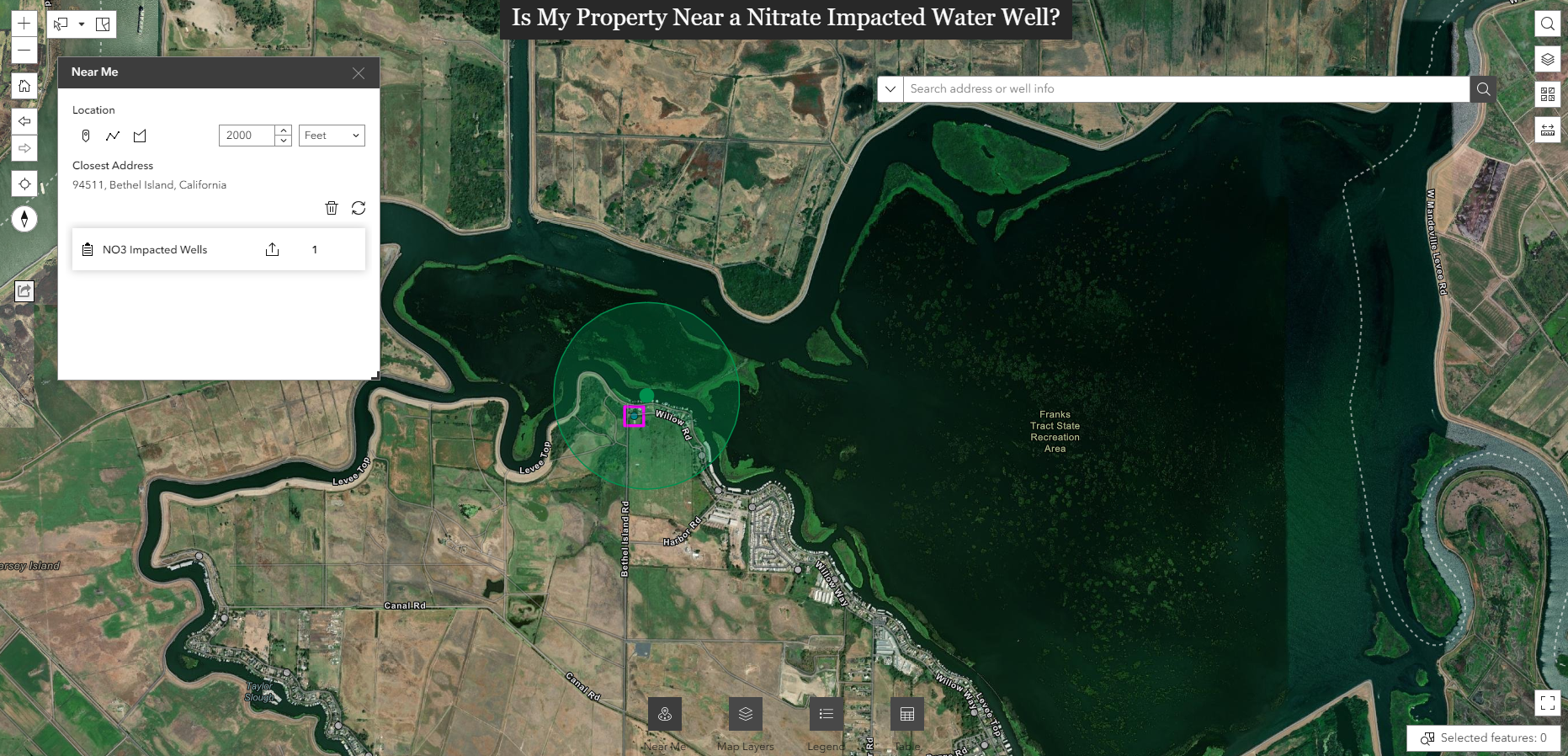
Is My Property Near a Nitrate Impacted Water Well?
- This interactive tool is intended for private domestic well owners to evaluate if their well is near a nitrate-impacted well. Enter your address or point of interest into the search bar (top left) to locate impacted wells nearby. Additional information about nitrate is provided.
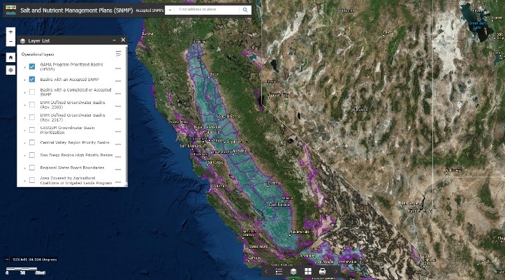
Salt and Nutrient Management Plans Webmap
- As part of the Recycled Water Policy adopted by the State Water Board, agencies, municipalities, and local stakeholders are to develop salt and nutrient management plans (SNMPs) for groundwater basins in California. This webmap tracks the status of SNMP development.
Digitized Well Completion Reports - (Coming Soon!)
Lead by the U.S. Geological Survey, the GAMA Program is digitizing well completion reports as we analyze the groundwater quality of shallow aquifers across California. Digitized data will include latitude/longitude, type of well, year completed, total depth, top of opening depth and number of openings, aquifer type, depth to static water level, including a link to the well completion report.
