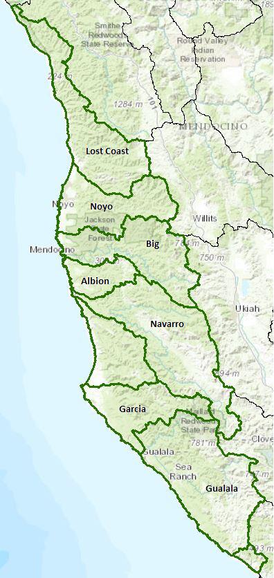
Mendocino Coast Unit - Hydrologic Unit 113
This hydrologic unit encompasses nine hydrologic areas (HA). Those with their own pages are listed below, each linked to a separate page. Note: all of these HAs include the near shore coastal areas.
Big River Watershed (HA 113.30)
Albion River Watershed (HA 113.40)
Navarro River Watershed (HA 113.50)
Garcia River Watershed (HA 113.70)
Gualala River Watershed (HA 113.80)
Watershed information links for the Mendocino Coast Hydrologic Unit in general are listed below. The individual watershed pages listed above contain additional links specific to those watersheds.
Water Quality, Flow, and Water Rights
2012 Water Quality Assessment Report
Every six years the North Coast Water Board evaluates water quality information and identifies water bodies that do not meet water quality standards and are not supporting their beneficial uses. Those waters are placed on a list of impaired water bodies that identifies the pollutant or stressor causing impairment and establishes a schedule for developing a control plan to address the impairment.
Impaired Water Bodies in the Mendocino Coast Unit |
||
Water Body Name |
Listing Extent |
Pollutant |
Albion River HA, Albion River |
Entire water body |
Sedimentation/Siltation Temperature |
Big River Beach at Mendocino Bay |
Entire water body |
Indicator Bacteria |
Big River HA, Berry Gulch |
Little North Fork Rocky Gulch, the Little North Fork, and Manley Gulch |
Temperature Oxygen, Dissolved |
Big River HA, Big River |
Cookhouse Gulch, Railroad Gulch, and the mainstem Big River Entire water body |
Oxygen, Dissolved Sedimentation/Siltation Temperature |
Caspar Headlands State Beach |
Entire water body |
Indicator Bacteria |
Garcia River HA, Garcia River |
Entire water body |
Sediment Temperature |
Gualala River HA, Gualala River |
Mainstem Gualala River Entire water body Entire water body except: the Little North Fork Gualala River and its tributaries |
Aluminum Sedimentation/Siltation Temperature |
Hare Creek Beach |
Entire water body |
Indicator Bacteria |
MacKerricher State Park (near Virgin Creek) |
Entire water body |
Indicator Bacteria |
Navarro River HA |
Entire water body |
Sedimentation/Siltation Temperature |
Navarro River HA, Delta |
Entire water body |
Sedimentation/Siltation |
Noyo River HA, Noyo River |
Entire water body (1) Mainstem Noyo River from confluence of Duffy Gulch downstream to confluence with Hayshed Gulch; (2) South Fork Noyo River mainstem from confluence of Kass Creek downstream to confluence with Noyo River mainstem; (3) Little North Fork Noyo River, (4) Duffy Gulch, and (5) Kass Creek tributaries. |
Sedimentation/Siltation Temperature |
Noyo River HA, Pudding Creek |
Pudding Creek Lagoon Mainstem Pudding Creek |
Indicator Bacteria4 Temperature |
Pudding Creek Beach |
Entire water body |
Indicator Bacteria |
Rockport HA, Ten Mile River HSA |
Entire water body Entire water body except: (1) Mill Creek, (2) Gulch 11, (3) Churchman Creek, (4) Little Bear Haven Creek, (5) Buckhorn Creek, (6) Booth Gulch, (7) Smith Creek, (8) Bear Haven Creek, and (9) the Little North Fork Ten Mile River |
Sedimentation/Siltation Temperature |
Main program page:
Map of water quality listed segments. (Click on the map tab)
Facilities Regulated by the Regional Water Board
This link is an interactive map of permitted facilities in California. You can zoom in to the watershed of your choice and click on a facility to obtain information.
Sanitary Sewer Overflow Incident Map
This link is an interactive map of overflows from sanitary sewers. You can zoom in to the watershed of your choice and click on an incident to obtain information.
2000 Ten Mile River TMDL for Sediment
1999 Noyo River TMDL for Sediment
2000 Navarro River TMDL for Sediment and Temperature
2002 Garcia River TMDL for Sediment
2008 North Coast Water Board's Sediment TMDL Implementation Workplan
The Regional Water Board adopted a TMDL implementation policy statement in 2004 and a subsequent Workplan in 2008 that details efforts to address sediment impaired water bodies in the region.
Water Rights Database
Statements of water diversion and use, registrations, certificates and water rights permits are accessible on the eWRIMS, electronic Water Rights Information Management System. This link includes a mapping application.
California Environmental Data Exchange Network
Water quality and habitat data and information are contained at this site in a spreadsheet format. Pay careful attention to the instructions.
Landscape Information
2005 N. Coast Water Board Watershed Initiative Chapter, Russian/Bodega WMA
The North Coast Region developed a Watershed Initiative Chapter as part of the State Water Board's Watershed Management Initiative that provides an overview of that watershed, a description of its water quality concerns and issues, past significant Regional Board activities in the watershed, activities as of 2005, near-term activities that would benefit the watershed, and activities which may happen on a longer time-scale.
California Geographic Information Portal
This portal has a search engine for the portal itself and ArcGIS online. Information and GIS layers can be accessed for a variety of data, including hillshade, vegetation, rivers, contours, stream fish habitat by reach, stream inventory reports, and CalWater 2.2 maps.
CalFire Fire and Resource Assessment Program
This site contains a wealth of information on the amount and extent of forest and rangelands along with analysis of conditions. Maps, projects, and assessments are available on the site, including GIS layers for timber harvesting, vegetation, and other resources.
U.S. Natural Resources Conservation Service Geospatial Data Gateway
Environmental and natural resources GIS files are available at this site, along with an interactive national map viewer.
Watershed Condition Information
2001 Water Board "Assessment of Aquatic Conditions in the Mendocino Coast Hydrologic Unit"
This report provides an analysis of instream data available in 2000 for the Ten Mile, Big, Albion and Gualala river watersheds. It was used in the development of Total Maximum Daily Loads ("TMDLs") for these watersheds, specifically the problem statements and numeric targets and to inform the implementation of the approved TMDLs.
Critical Coastal Areas
This program is administered by the California Coastal Commission and State Water Resources Control Board to foster collaboration on addressing issues associated with polluted runoff in critical coastal areas.
Klamath Resource Information System
This system was originally developed as a data repository and analysis and management tool for the Klamath River watershed. A host of information is available through this site, including maps, water quality data, fisheries data, photographs, and scientific references.
Ten Mile River
Noyo River
Navarro River
Garcia River
California EcoAtlas
This website provides access to information on wetlands, including integration of some water quality information.
Watershed Groups, Partnerships, and Collaboration
The Conservation Fund
The Conservation Fund owns lands in the Usal Creek, Big River, Salmon Creek, Garcia River, and Gualala River watersheds.
California Watershed Network
This nonprofit organization was formed in 2000 to help protect and restore watersheds in California through community-based networks. The website contains some information on watershed events and older information on watersheds of interest, but most of it has not been updated since 2011.
Salmonid Restoration Federation
This nonprofit group was formed in 1986 to assist salmonid restoration efforts in California by promoting "restoration, stewardship, and recovery of California native salmon, steelhead and trout populations through education, collaboration, and advocacy." Their web site contains a wealth of information on salmonids and habitat and stream restoration in California.
UC Davis Information Center for the Environment, Natural Resource Project Inventory
This database provides information on natural resource projects in California, including links to data and information collected by the projects.
Fisheries and Wildlife Information
CA Dept Fish and Wildlife Stream Inventory Reports
This California DFW site allows searches by major watershed areas (search on Mendocino Coast).
National Oceanic and Atmospheric Administration
NOAA Fisheries is responsible for listing and recovery efforts for anadromous fishes. The 2012 Recovery Plan for coho salmon in the North Central California Coast ESU contains information on the habitat, population status, stressors and threats, recovery efforts, and recovery strategy (includes Lost Coast and Navarro Pt.-Gualala Pt. strata and specific watersheds in the Unit).
CalFish Cooperative Anadromous Fish and Habitat Data Program
This cooperative agency site provides information on anadromous fish habitat and populations in an interactive environment. The site has numerous links to information libraries and systems in California.
Areas of Special Biological Significance
The State Water Resources Control Board has designated Areas of Special Biological Significance (ASBS) as those "ocean areas requiring protection of species of biological communities to the extent that alteration of natural water quality is undesirable." They are included under the Marine Managed Areas Improvement Act (The Marine Managed Areas Improvement Act (Chapter 7 (commencing with Section 36600) of Division 27 of the Public Resources Code.)
Information on Gerstle Cove, Jughandle Cove, and the Kelp Beds at Saunders Reef ASBS are available at:
Gerstle Cove
Jughandle Cove
- https://www.waterboards.ca.gov/water_issues/programs/ocean/docs/asbs/asbs_areas/asbs_swqpa_publication03.pdf
- http://www.cacoastkeeper.org/document/factsheet_asbs1.pdf
- http://www.parks.ca.gov/?page_id=441
Saunders Reef
The Nature Conservancy's "California Salmon Snapshots"
This website contains information on salmon populations and resources in California. This link provides information on the following Mendocino Coast watersheds: Albion River, Big River, Caspar Creek, Garcia River, Little River, Navarro River, Noyo River, Pudding Creek, Ten Mile River, and Usal Creek.
The links and information on this page are provided in an attempt to make a broad range of information available on a watershed basis. While the Water Board has been involved in work within watersheds with a variety of agencies and watershed groups, we cannot vouch for the currency or accuracy of information contained within the internet links we have included. We suggest that you check with the original sources if there is any question regarding currency, accuracy, or origin of information.
Created February 4, 2015; revised February 3, 2016
Web page contact : Robert Klamt, rklamt@waterboards.ca.gov
(Page last updated 10/16/17)
Water is a precious resource in California, and maintaining its quality is of utmost importance to safeguard the health of the public and the environment.
Statewide Campaigns
EPA Water Sense
File an Environmental Complaint
Save Our Water
Flex Alert
Register to Vote
